You are here: Home > Network List > UW - Pacific Northwest Regional Seismic Network Stations List
> Station UMAT Pilot Rock, OR, USA > Earthquake Result Viewer
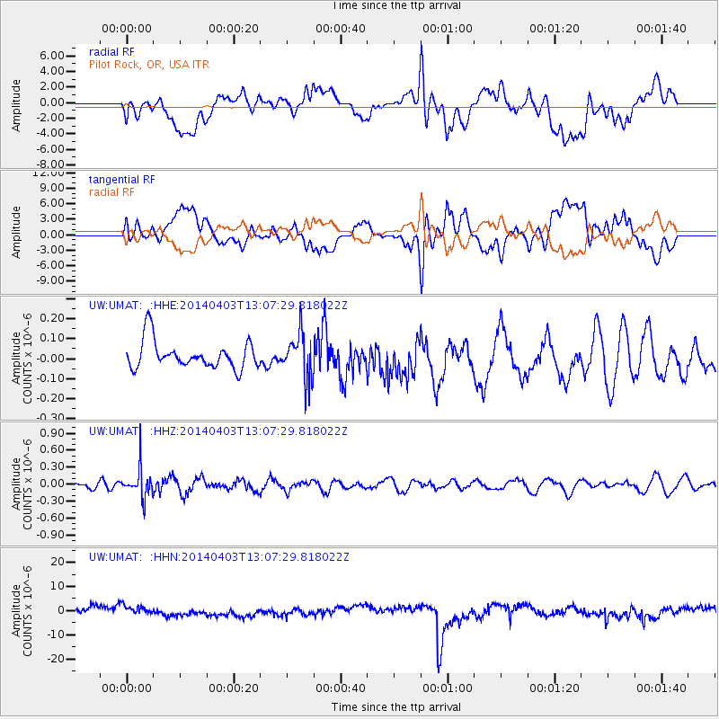
UMAT Pilot Rock, OR, USA - Earthquake Result Viewer
*The percent match for this event was below the threshold and hence no stack was calculated.
| Earthquake location: |
Fiji Islands Region |
| Earthquake latitude/longitude: |
-18.0/-178.4 |
| Earthquake time(UTC): |
2014/04/03 (093) 12:56:36 GMT |
| Earthquake Depth: |
579 km |
| Earthquake Magnitude: |
5.3 mb |
| Earthquake Catalog/Contributor: |
ISC/ISC |
|
| Network: |
UW Pacific Northwest Regional Seismic Network |
| Station: |
UMAT Pilot Rock, OR, USA |
| Lat/Lon: |
45.29 N/118.96 W |
| Elevation: |
1318 m |
|
| Distance: |
82.9 deg |
| Az: |
37.756 deg |
| Baz: |
235.622 deg |
| Ray Param: |
$rayparam |
*The percent match for this event was below the threshold and hence was not used in the summary stack. |
|
| Radial Match: |
39.999306 % |
| Radial Bump: |
400 |
| Transverse Match: |
39.5735 % |
| Transverse Bump: |
400 |
| SOD ConfigId: |
3390531 |
| Insert Time: |
2019-04-11 03:28:34.805 +0000 |
| GWidth: |
2.5 |
| Max Bumps: |
400 |
| Tol: |
0.001 |
|
Signal To Noise
| Channel | StoN | STA | LTA |
| UW:UMAT: :HHZ:20140403T13:07:29.818022Z | 3.7116003 | 2.590295E-7 | 6.9789166E-8 |
| UW:UMAT: :HHN:20140403T13:07:29.818022Z | 1.2176137 | 2.193168E-6 | 1.8012018E-6 |
| UW:UMAT: :HHE:20140403T13:07:29.818022Z | 1.6625224 | 1.1502554E-7 | 6.918736E-8 |
| Arrivals |
| Ps | |
| PpPs | |
| PsPs/PpSs | |


