You are here: Home > Network List > CI - Caltech Regional Seismic Network Stations List
> Station TIN Tinemaha, Big Pine, CA, USA > Earthquake Result Viewer
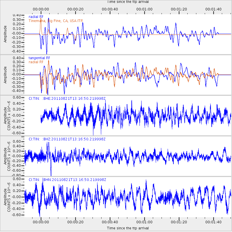
TIN Tinemaha, Big Pine, CA, USA - Earthquake Result Viewer
*The percent match for this event was below the threshold and hence no stack was calculated.
| Earthquake location: |
New Britain Region, P.N.G. |
| Earthquake latitude/longitude: |
-5.6/151.0 |
| Earthquake time(UTC): |
2011/08/21 (233) 13:04:08 GMT |
| Earthquake Depth: |
40 km |
| Earthquake Magnitude: |
5.5 MS, 5.4 MB, 5.8 MW, 5.8 MW |
| Earthquake Catalog/Contributor: |
WHDF/NEIC |
|
| Network: |
CI Caltech Regional Seismic Network |
| Station: |
TIN Tinemaha, Big Pine, CA, USA |
| Lat/Lon: |
37.05 N/118.23 W |
| Elevation: |
1197 m |
|
| Distance: |
93.9 deg |
| Az: |
53.303 deg |
| Baz: |
266.013 deg |
| Ray Param: |
$rayparam |
*The percent match for this event was below the threshold and hence was not used in the summary stack. |
|
| Radial Match: |
54.52023 % |
| Radial Bump: |
400 |
| Transverse Match: |
59.631054 % |
| Transverse Bump: |
400 |
| SOD ConfigId: |
414626 |
| Insert Time: |
2012-01-13 05:44:16.436 +0000 |
| GWidth: |
2.5 |
| Max Bumps: |
400 |
| Tol: |
0.001 |
|
Signal To Noise
| Channel | StoN | STA | LTA |
| CI:TIN: :BHZ:20110821T13:16:50.219998Z | 1.4852147 | 2.0624049E-7 | 1.388624E-7 |
| CI:TIN: :BHN:20110821T13:16:50.219998Z | 1.4051838 | 2.389706E-7 | 1.700636E-7 |
| CI:TIN: :BHE:20110821T13:16:50.219998Z | 1.4413698 | 2.1761358E-7 | 1.5097692E-7 |
| Arrivals |
| Ps | |
| PpPs | |
| PsPs/PpSs | |


