You are here: Home > Network List > CI - Caltech Regional Seismic Network Stations List
> Station SMM Simmler, CA, USA > Earthquake Result Viewer
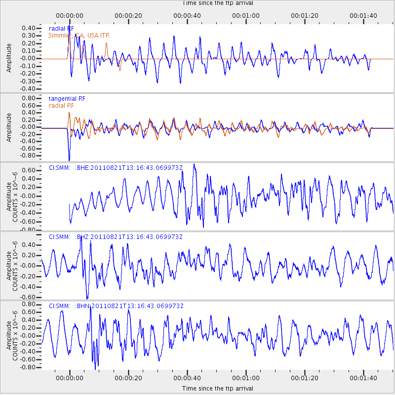
SMM Simmler, CA, USA - Earthquake Result Viewer
*The percent match for this event was below the threshold and hence no stack was calculated.
| Earthquake location: |
New Britain Region, P.N.G. |
| Earthquake latitude/longitude: |
-5.6/151.0 |
| Earthquake time(UTC): |
2011/08/21 (233) 13:04:08 GMT |
| Earthquake Depth: |
40 km |
| Earthquake Magnitude: |
5.5 MS, 5.4 MB, 5.8 MW, 5.8 MW |
| Earthquake Catalog/Contributor: |
WHDF/NEIC |
|
| Network: |
CI Caltech Regional Seismic Network |
| Station: |
SMM Simmler, CA, USA |
| Lat/Lon: |
35.31 N/120.00 W |
| Elevation: |
599 m |
|
| Distance: |
92.3 deg |
| Az: |
54.923 deg |
| Baz: |
264.887 deg |
| Ray Param: |
$rayparam |
*The percent match for this event was below the threshold and hence was not used in the summary stack. |
|
| Radial Match: |
56.381718 % |
| Radial Bump: |
400 |
| Transverse Match: |
51.40571 % |
| Transverse Bump: |
400 |
| SOD ConfigId: |
414626 |
| Insert Time: |
2012-01-13 05:45:00.469 +0000 |
| GWidth: |
2.5 |
| Max Bumps: |
400 |
| Tol: |
0.001 |
|
Signal To Noise
| Channel | StoN | STA | LTA |
| CI:SMM: :BHZ:20110821T13:16:43.069973Z | 1.2290802 | 2.4881095E-7 | 2.0243672E-7 |
| CI:SMM: :BHN:20110821T13:16:43.069973Z | 0.9468474 | 2.5996587E-7 | 2.7455943E-7 |
| CI:SMM: :BHE:20110821T13:16:43.069973Z | 1.5750062 | 3.230452E-7 | 2.0510726E-7 |
| Arrivals |
| Ps | |
| PpPs | |
| PsPs/PpSs | |


