You are here: Home > Network List > TA - USArray Transportable Network (new EarthScope stations) Stations List
> Station O03D Paynes Creek, CA, USA > Earthquake Result Viewer
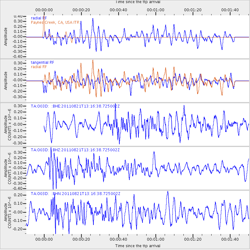
O03D Paynes Creek, CA, USA - Earthquake Result Viewer
*The percent match for this event was below the threshold and hence no stack was calculated.
| Earthquake location: |
New Britain Region, P.N.G. |
| Earthquake latitude/longitude: |
-5.6/151.0 |
| Earthquake time(UTC): |
2011/08/21 (233) 13:04:08 GMT |
| Earthquake Depth: |
40 km |
| Earthquake Magnitude: |
5.5 MS, 5.4 MB, 5.8 MW, 5.8 MW |
| Earthquake Catalog/Contributor: |
WHDF/NEIC |
|
| Network: |
TA USArray Transportable Network (new EarthScope stations) |
| Station: |
O03D Paynes Creek, CA, USA |
| Lat/Lon: |
40.29 N/121.80 W |
| Elevation: |
968 m |
|
| Distance: |
91.4 deg |
| Az: |
49.833 deg |
| Baz: |
263.95 deg |
| Ray Param: |
$rayparam |
*The percent match for this event was below the threshold and hence was not used in the summary stack. |
|
| Radial Match: |
48.176025 % |
| Radial Bump: |
400 |
| Transverse Match: |
41.211163 % |
| Transverse Bump: |
381 |
| SOD ConfigId: |
414626 |
| Insert Time: |
2012-01-13 05:48:09.601 +0000 |
| GWidth: |
2.5 |
| Max Bumps: |
400 |
| Tol: |
0.001 |
|
Signal To Noise
| Channel | StoN | STA | LTA |
| TA:O03D: :BHZ:20110821T13:16:38.725002Z | 2.639461 | 1.6420056E-7 | 6.220988E-8 |
| TA:O03D: :BHN:20110821T13:16:38.725002Z | 0.8823726 | 6.5164535E-8 | 7.3851496E-8 |
| TA:O03D: :BHE:20110821T13:16:38.725002Z | 1.0772898 | 1.0533681E-7 | 9.7779456E-8 |
| Arrivals |
| Ps | |
| PpPs | |
| PsPs/PpSs | |


