You are here: Home > Network List > UW - Pacific Northwest Regional Seismic Network Stations List
> Station LEBA Lebam, WA, USA > Earthquake Result Viewer
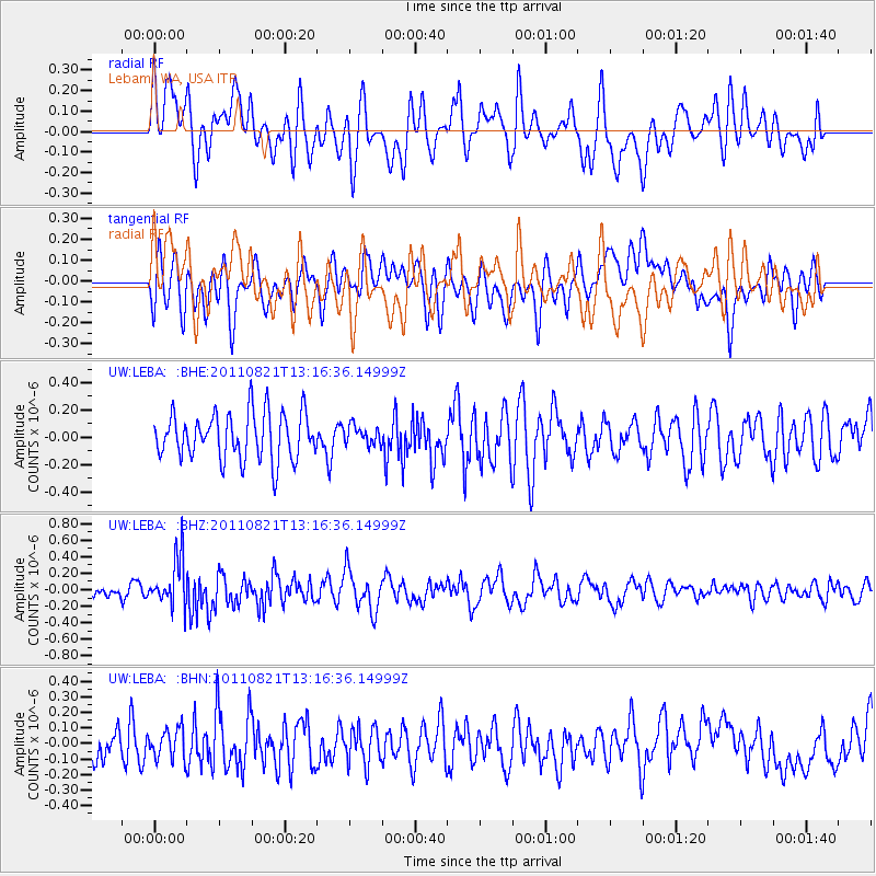
LEBA Lebam, WA, USA - Earthquake Result Viewer
*The percent match for this event was below the threshold and hence no stack was calculated.
| Earthquake location: |
New Britain Region, P.N.G. |
| Earthquake latitude/longitude: |
-5.6/151.0 |
| Earthquake time(UTC): |
2011/08/21 (233) 13:04:08 GMT |
| Earthquake Depth: |
40 km |
| Earthquake Magnitude: |
5.5 MS, 5.4 MB, 5.8 MW, 5.8 MW |
| Earthquake Catalog/Contributor: |
WHDF/NEIC |
|
| Network: |
UW Pacific Northwest Regional Seismic Network |
| Station: |
LEBA Lebam, WA, USA |
| Lat/Lon: |
46.55 N/123.56 W |
| Elevation: |
73 m |
|
| Distance: |
90.8 deg |
| Az: |
43.477 deg |
| Baz: |
262.868 deg |
| Ray Param: |
$rayparam |
*The percent match for this event was below the threshold and hence was not used in the summary stack. |
|
| Radial Match: |
57.189507 % |
| Radial Bump: |
400 |
| Transverse Match: |
58.435154 % |
| Transverse Bump: |
400 |
| SOD ConfigId: |
414626 |
| Insert Time: |
2012-01-13 05:49:10.223 +0000 |
| GWidth: |
2.5 |
| Max Bumps: |
400 |
| Tol: |
0.001 |
|
Signal To Noise
| Channel | StoN | STA | LTA |
| UW:LEBA: :BHZ:20110821T13:16:36.14999Z | 2.4593806 | 2.9112914E-7 | 1.1837499E-7 |
| UW:LEBA: :BHN:20110821T13:16:36.14999Z | 0.8013372 | 9.656201E-8 | 1.205011E-7 |
| UW:LEBA: :BHE:20110821T13:16:36.14999Z | 0.40312734 | 6.9224036E-8 | 1.7171755E-7 |
| Arrivals |
| Ps | |
| PpPs | |
| PsPs/PpSs | |


