You are here: Home > Network List > IU - Global Seismograph Network (GSN - IRIS/USGS) Stations List
> Station XMAS Kiritimati Island, Republic of Kiribati > Earthquake Result Viewer
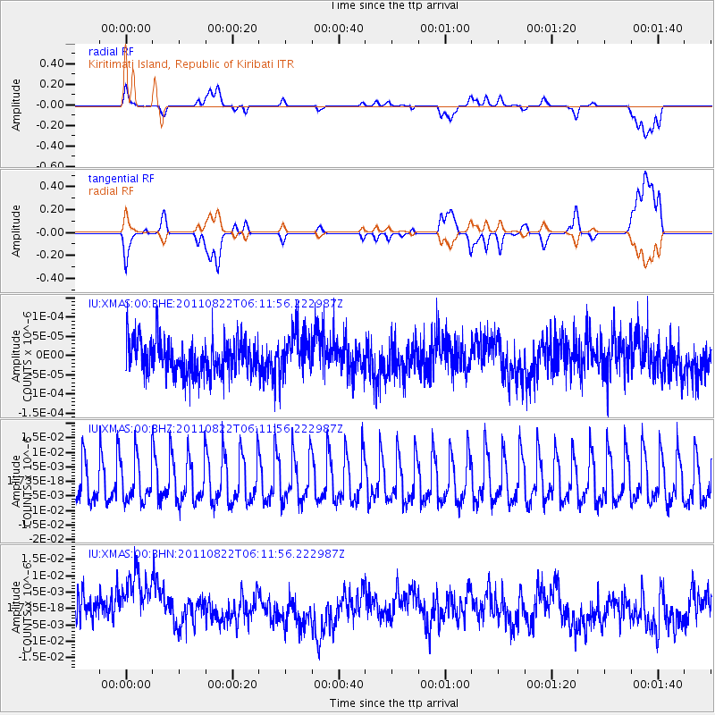
XMAS Kiritimati Island, Republic of Kiribati - Earthquake Result Viewer
*The percent match for this event was below the threshold and hence no stack was calculated.
| Earthquake location: |
Vanuatu Islands |
| Earthquake latitude/longitude: |
-17.4/167.3 |
| Earthquake time(UTC): |
2011/08/22 (234) 06:04:53 GMT |
| Earthquake Depth: |
10 km |
| Earthquake Magnitude: |
5.7 MW, 5.2 MS, 5.4 MB, 5.7 MW |
| Earthquake Catalog/Contributor: |
WHDF/NEIC |
|
| Network: |
IU Global Seismograph Network (GSN - IRIS/USGS) |
| Station: |
XMAS Kiritimati Island, Republic of Kiribati |
| Lat/Lon: |
2.04 N/157.45 W |
| Elevation: |
20 m |
|
| Distance: |
39.8 deg |
| Az: |
64.394 deg |
| Baz: |
239.479 deg |
| Ray Param: |
$rayparam |
*The percent match for this event was below the threshold and hence was not used in the summary stack. |
|
| Radial Match: |
35.56709 % |
| Radial Bump: |
400 |
| Transverse Match: |
35.57348 % |
| Transverse Bump: |
400 |
| SOD ConfigId: |
414626 |
| Insert Time: |
2012-01-13 05:58:28.130 +0000 |
| GWidth: |
2.5 |
| Max Bumps: |
400 |
| Tol: |
0.001 |
|
Signal To Noise
| Channel | StoN | STA | LTA |
| IU:XMAS:00:BHZ:20110822T06:11:56.222987Z | 0.90512294 | 7.101342E-9 | 7.8457205E-9 |
| IU:XMAS:00:BHN:20110822T06:11:56.222987Z | 1.9732509 | 1.0199708E-8 | 5.1689866E-9 |
| IU:XMAS:00:BHE:20110822T06:11:56.222987Z | 1.2381475 | 5.5956236E-11 | 4.5193516E-11 |
| Arrivals |
| Ps | |
| PpPs | |
| PsPs/PpSs | |


