You are here: Home > Network List > TA - USArray Transportable Network (new EarthScope stations) Stations List
> Station O03D Paynes Creek, CA, USA > Earthquake Result Viewer
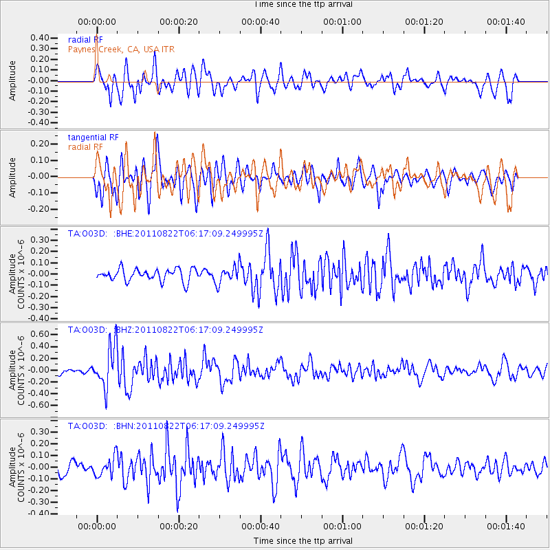
O03D Paynes Creek, CA, USA - Earthquake Result Viewer
*The percent match for this event was below the threshold and hence no stack was calculated.
| Earthquake location: |
Vanuatu Islands |
| Earthquake latitude/longitude: |
-17.4/167.3 |
| Earthquake time(UTC): |
2011/08/22 (234) 06:04:53 GMT |
| Earthquake Depth: |
10 km |
| Earthquake Magnitude: |
5.7 MW, 5.2 MS, 5.4 MB, 5.7 MW |
| Earthquake Catalog/Contributor: |
WHDF/NEIC |
|
| Network: |
TA USArray Transportable Network (new EarthScope stations) |
| Station: |
O03D Paynes Creek, CA, USA |
| Lat/Lon: |
40.29 N/121.80 W |
| Elevation: |
968 m |
|
| Distance: |
87.3 deg |
| Az: |
46.359 deg |
| Baz: |
244.591 deg |
| Ray Param: |
$rayparam |
*The percent match for this event was below the threshold and hence was not used in the summary stack. |
|
| Radial Match: |
65.73097 % |
| Radial Bump: |
400 |
| Transverse Match: |
72.1339 % |
| Transverse Bump: |
400 |
| SOD ConfigId: |
414626 |
| Insert Time: |
2012-01-13 06:02:24.729 +0000 |
| GWidth: |
2.5 |
| Max Bumps: |
400 |
| Tol: |
0.001 |
|
Signal To Noise
| Channel | StoN | STA | LTA |
| TA:O03D: :BHZ:20110822T06:17:09.249995Z | 6.4096174 | 3.6307807E-7 | 5.6645824E-8 |
| TA:O03D: :BHN:20110822T06:17:09.249995Z | 1.1846024 | 8.330278E-8 | 7.03213E-8 |
| TA:O03D: :BHE:20110822T06:17:09.249995Z | 1.4707152 | 7.890094E-8 | 5.3648005E-8 |
| Arrivals |
| Ps | |
| PpPs | |
| PsPs/PpSs | |


