You are here: Home > Network List > UW - Pacific Northwest Regional Seismic Network Stations List
> Station LEBA Lebam, WA, USA > Earthquake Result Viewer
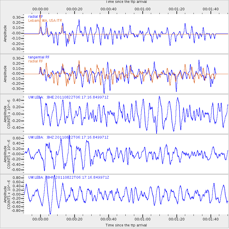
LEBA Lebam, WA, USA - Earthquake Result Viewer
*The percent match for this event was below the threshold and hence no stack was calculated.
| Earthquake location: |
Vanuatu Islands |
| Earthquake latitude/longitude: |
-17.4/167.3 |
| Earthquake time(UTC): |
2011/08/22 (234) 06:04:53 GMT |
| Earthquake Depth: |
10 km |
| Earthquake Magnitude: |
5.7 MW, 5.2 MS, 5.4 MB, 5.7 MW |
| Earthquake Catalog/Contributor: |
WHDF/NEIC |
|
| Network: |
UW Pacific Northwest Regional Seismic Network |
| Station: |
LEBA Lebam, WA, USA |
| Lat/Lon: |
46.55 N/123.56 W |
| Elevation: |
73 m |
|
| Distance: |
88.9 deg |
| Az: |
40.181 deg |
| Baz: |
243.179 deg |
| Ray Param: |
$rayparam |
*The percent match for this event was below the threshold and hence was not used in the summary stack. |
|
| Radial Match: |
48.783047 % |
| Radial Bump: |
400 |
| Transverse Match: |
42.786465 % |
| Transverse Bump: |
383 |
| SOD ConfigId: |
414626 |
| Insert Time: |
2012-01-13 06:04:06.138 +0000 |
| GWidth: |
2.5 |
| Max Bumps: |
400 |
| Tol: |
0.001 |
|
Signal To Noise
| Channel | StoN | STA | LTA |
| UW:LEBA: :BHZ:20110822T06:17:16.849971Z | 2.3077843 | 2.920298E-7 | 1.265412E-7 |
| UW:LEBA: :BHN:20110822T06:17:16.849971Z | 1.3604662 | 4.43894E-7 | 3.262808E-7 |
| UW:LEBA: :BHE:20110822T06:17:16.849971Z | 0.7106374 | 1.46641E-7 | 2.0635137E-7 |
| Arrivals |
| Ps | |
| PpPs | |
| PsPs/PpSs | |


