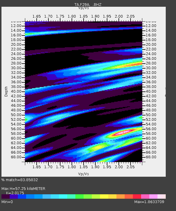
F29A Eureka, SD, USA - Earthquake Result Viewer
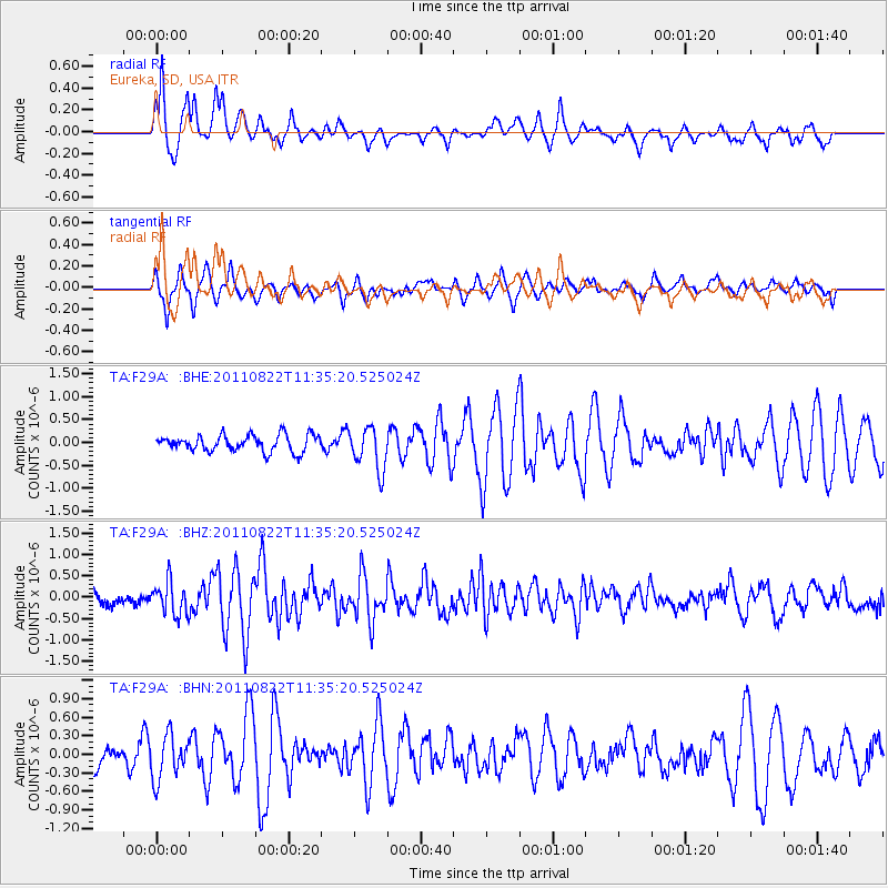
Earthquake location: Near East Coast Of Honshu, Japan
Earthquake latitude/longitude: 36.1/141.7
Earthquake time(UTC): 2011/08/22 (234) 11:23:35 GMT
Earthquake Depth: 12 km
Earthquake Magnitude: 5.5 MB, 5.8 MS, 6.0 MW, 5.8 MW
Earthquake Catalog/Contributor: WHDF/NEIC
Network: TA USArray Transportable Network (new EarthScope stations)
Station: F29A Eureka, SD, USA
Lat/Lon: 45.83 N/99.83 W
Elevation: 575 m
Distance: 81.4 deg
Az: 38.423 deg
Baz: 313.943 deg
Ray Param: 0.047593642
Estimated Moho Depth: 57.25 km
Estimated Crust Vp/Vs: 2.02
Assumed Crust Vp: 6.53 km/s
Estimated Crust Vs: 3.237 km/s
Estimated Crust Poisson's Ratio: 0.34
Radial Match: 83.85832 %
Radial Bump: 298
Transverse Match: 63.502316 %
Transverse Bump: 396
SOD ConfigId: 414626
Insert Time: 2012-01-13 06:24:44.566 +0000
GWidth: 2.5
Max Bumps: 400
Tol: 0.001

Signal To Noise

ChannelStoNSTALTA
TA:F29A: :BHZ:20110822T11:35:20.525024Z3.00792053.862887E-71.2842385E-7
TA:F29A: :BHN:20110822T11:35:20.525024Z2.0410863.5272024E-71.7281008E-7
TA:F29A: :BHE:20110822T11:35:20.525024Z2.60726264.675054E-71.7930891E-7
Arrivals
Ps9.1 SECOND
PpPs26 SECOND
PsPs/PpSs35 SECOND