You are here: Home > Network List > TA - USArray Transportable Network (new EarthScope stations) Stations List
> Station Q34A Chapman, KS, USA > Earthquake Result Viewer
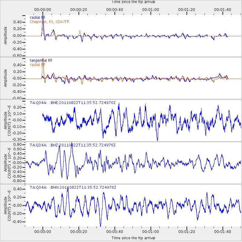
Q34A Chapman, KS, USA - Earthquake Result Viewer
*The percent match for this event was below the threshold and hence no stack was calculated.
| Earthquake location: |
Near East Coast Of Honshu, Japan |
| Earthquake latitude/longitude: |
36.1/141.7 |
| Earthquake time(UTC): |
2011/08/22 (234) 11:23:35 GMT |
| Earthquake Depth: |
12 km |
| Earthquake Magnitude: |
5.5 MB, 5.8 MS, 6.0 MW, 5.8 MW |
| Earthquake Catalog/Contributor: |
WHDF/NEIC |
|
| Network: |
TA USArray Transportable Network (new EarthScope stations) |
| Station: |
Q34A Chapman, KS, USA |
| Lat/Lon: |
38.92 N/96.94 W |
| Elevation: |
378 m |
|
| Distance: |
87.8 deg |
| Az: |
41.798 deg |
| Baz: |
316.202 deg |
| Ray Param: |
$rayparam |
*The percent match for this event was below the threshold and hence was not used in the summary stack. |
|
| Radial Match: |
73.11322 % |
| Radial Bump: |
400 |
| Transverse Match: |
65.29071 % |
| Transverse Bump: |
400 |
| SOD ConfigId: |
414626 |
| Insert Time: |
2012-01-13 06:29:52.512 +0000 |
| GWidth: |
2.5 |
| Max Bumps: |
400 |
| Tol: |
0.001 |
|
Signal To Noise
| Channel | StoN | STA | LTA |
| TA:Q34A: :BHZ:20110822T11:35:52.724976Z | 3.6275973 | 2.5989053E-7 | 7.16426E-8 |
| TA:Q34A: :BHN:20110822T11:35:52.724976Z | 0.88007075 | 6.306446E-8 | 7.16584E-8 |
| TA:Q34A: :BHE:20110822T11:35:52.724976Z | 1.7904003 | 1.2936381E-7 | 7.225413E-8 |
| Arrivals |
| Ps | |
| PpPs | |
| PsPs/PpSs | |


