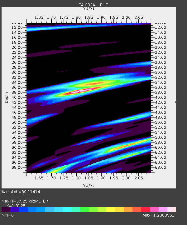
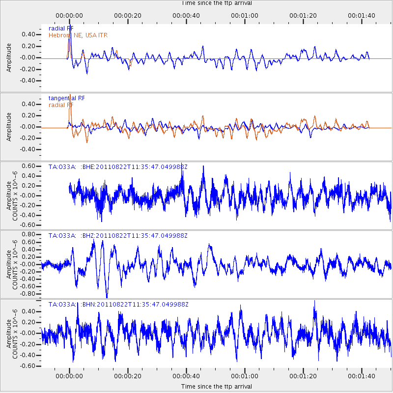
O33A Hebron, NE, USA - Earthquake Result Viewer

Earthquake location: Near East Coast Of Honshu, Japan
Earthquake latitude/longitude: 36.1/141.7
Earthquake time(UTC): 2011/08/22 (234) 11:23:35 GMT
Earthquake Depth: 12 km
Earthquake Magnitude: 5.5 MB, 5.8 MS, 6.0 MW, 5.8 MW
Earthquake Catalog/Contributor: WHDF/NEIC
Network: TA USArray Transportable Network (new EarthScope stations)
Station: O33A Hebron, NE, USA
Lat/Lon: 40.08 N/97.58 W
Elevation: 480 m
Distance: 86.7 deg
Az: 41.355 deg
Baz: 315.772 deg
Ray Param: 0.04389403
Estimated Moho Depth: 37.25 km
Estimated Crust Vp/Vs: 1.81
Assumed Crust Vp: 6.498 km/s
Estimated Crust Vs: 3.585 km/s
Estimated Crust Poisson's Ratio: 0.28
Radial Match: 80.11414 %
Radial Bump: 400
Transverse Match: 61.298164 %
Transverse Bump: 400
SOD ConfigId: 414626
Insert Time: 2012-01-13 06:30:21.521 +0000
GWidth: 2.5
Max Bumps: 400
Tol: 0.001

Signal To Noise

ChannelStoNSTALTA
TA:O33A: :BHZ:20110822T11:35:47.049988Z3.59886152.5709195E-77.143702E-8
TA:O33A: :BHN:20110822T11:35:47.049988Z1.71710262.0545139E-71.1965004E-7
TA:O33A: :BHE:20110822T11:35:47.049988Z0.831351461.1534932E-71.3874916E-7
Arrivals
Ps4.8 SECOND
PpPs16 SECOND
PsPs/PpSs21 SECOND