O03D Paynes Creek, CA, USA - Earthquake Result Viewer
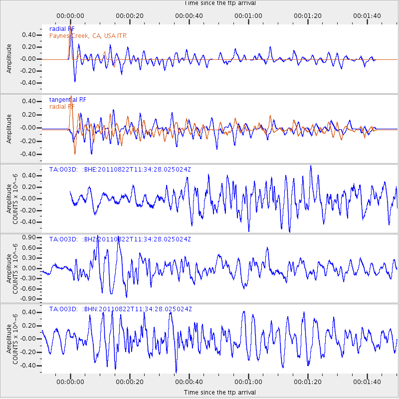
Earthquake location: Near East Coast Of Honshu, Japan
Earthquake latitude/longitude: 36.1/141.7
Earthquake time(UTC): 2011/08/22 (234) 11:23:35 GMT
Earthquake Depth: 12 km
Earthquake Magnitude: 5.5 MB, 5.8 MS, 6.0 MW, 5.8 MW
Earthquake Catalog/Contributor: WHDF/NEIC
Network: TA USArray Transportable Network (new EarthScope stations)
Station: O03D Paynes Creek, CA, USA
Lat/Lon: 40.29 N/121.80 W
Elevation: 968 m
Distance: 72.1 deg
Az: 52.999 deg
Baz: 302.243 deg
Ray Param: 0.053887118
Estimated Moho Depth: 22.25 km
Estimated Crust Vp/Vs: 1.84
Assumed Crust Vp: 6.566 km/s
Estimated Crust Vs: 3.573 km/s
Estimated Crust Poisson's Ratio: 0.29
Radial Match: 80.31291 %
Radial Bump: 400
Transverse Match: 78.779305 %
Transverse Bump: 400
SOD ConfigId: 414626
Insert Time: 2012-01-13 06:33:23.968 +0000
GWidth: 2.5
Max Bumps: 400
Tol: 0.001

Signal To Noise

ChannelStoNSTALTA
TA:O03D: :BHZ:20110822T11:34:28.025024Z2.58273961.5955558E-76.1777655E-8
TA:O03D: :BHN:20110822T11:34:28.025024Z1.16626997.832843E-86.7161494E-8
TA:O03D: :BHE:20110822T11:34:28.025024Z0.96458789.396477E-89.741443E-8
Arrivals
Ps2.9 SECOND
PpPs9.3 SECOND
PsPs/PpSs12 SECOND