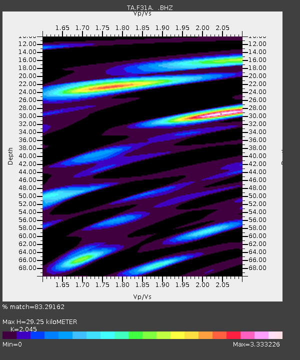
F31A Hecla, SD, USA - Earthquake Result Viewer
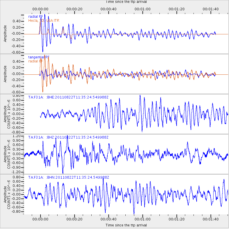
Earthquake location: Near East Coast Of Honshu, Japan
Earthquake latitude/longitude: 36.1/141.7
Earthquake time(UTC): 2011/08/22 (234) 11:23:35 GMT
Earthquake Depth: 12 km
Earthquake Magnitude: 5.5 MB, 5.8 MS, 6.0 MW, 5.8 MW
Earthquake Catalog/Contributor: WHDF/NEIC
Network: TA USArray Transportable Network (new EarthScope stations)
Station: F31A Hecla, SD, USA
Lat/Lon: 45.86 N/98.25 W
Elevation: 412 m
Distance: 82.2 deg
Az: 37.625 deg
Baz: 314.955 deg
Ray Param: 0.047055416
Estimated Moho Depth: 29.25 km
Estimated Crust Vp/Vs: 2.05
Assumed Crust Vp: 6.53 km/s
Estimated Crust Vs: 3.193 km/s
Estimated Crust Poisson's Ratio: 0.34
Radial Match: 83.29162 %
Radial Bump: 400
Transverse Match: 73.70943 %
Transverse Bump: 400
SOD ConfigId: 414626
Insert Time: 2012-01-13 06:34:43.650 +0000
GWidth: 2.5
Max Bumps: 400
Tol: 0.001

Signal To Noise

ChannelStoNSTALTA
TA:F31A: :BHZ:20110822T11:35:24.549988Z4.00698333.832115E-79.563592E-8
TA:F31A: :BHN:20110822T11:35:24.549988Z1.37621872.615857E-71.900757E-7
TA:F31A: :BHE:20110822T11:35:24.549988Z2.68712142.557254E-79.5167046E-8
Arrivals
Ps4.8 SECOND
PpPs13 SECOND
PsPs/PpSs18 SECOND