G34A Benson, MN, USA - Earthquake Result Viewer
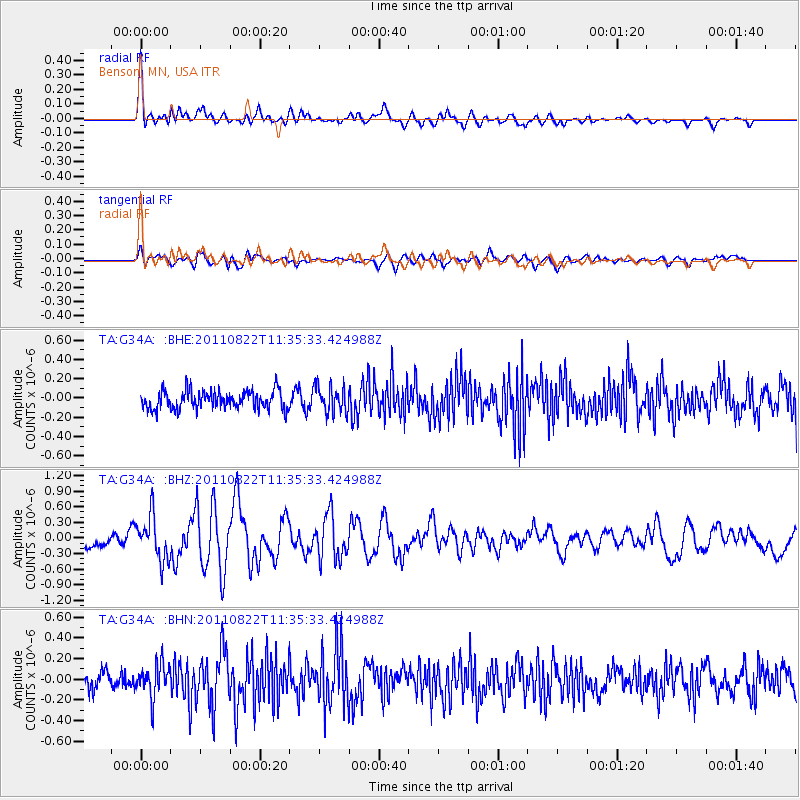
Earthquake location: Near East Coast Of Honshu, Japan
Earthquake latitude/longitude: 36.1/141.7
Earthquake time(UTC): 2011/08/22 (234) 11:23:35 GMT
Earthquake Depth: 12 km
Earthquake Magnitude: 5.5 MB, 5.8 MS, 6.0 MW, 5.8 MW
Earthquake Catalog/Contributor: WHDF/NEIC
Network: TA USArray Transportable Network (new EarthScope stations)
Station: G34A Benson, MN, USA
Lat/Lon: 45.24 N/95.64 W
Elevation: 316 m
Distance: 83.9 deg
Az: 36.732 deg
Baz: 316.708 deg
Ray Param: 0.045845862
Estimated Moho Depth: 46.0 km
Estimated Crust Vp/Vs: 1.90
Assumed Crust Vp: 6.571 km/s
Estimated Crust Vs: 3.463 km/s
Estimated Crust Poisson's Ratio: 0.31
Radial Match: 80.10484 %
Radial Bump: 400
Transverse Match: 62.009193 %
Transverse Bump: 400
SOD ConfigId: 414626
Insert Time: 2012-01-13 06:35:22.024 +0000
GWidth: 2.5
Max Bumps: 400
Tol: 0.001

Signal To Noise

ChannelStoNSTALTA
TA:G34A: :BHZ:20110822T11:35:33.424988Z4.02221734.2380245E-71.0536538E-7
TA:G34A: :BHN:20110822T11:35:33.424988Z1.6589141.5948093E-79.613575E-8
TA:G34A: :BHE:20110822T11:35:33.424988Z1.45341581.3830926E-79.5161525E-8
Arrivals
Ps6.4 SECOND
PpPs20 SECOND
PsPs/PpSs26 SECOND