You are here: Home > Network List > TA - USArray Transportable Network (new EarthScope stations) Stations List
> Station L02D Cave Junction, OR, USA > Earthquake Result Viewer
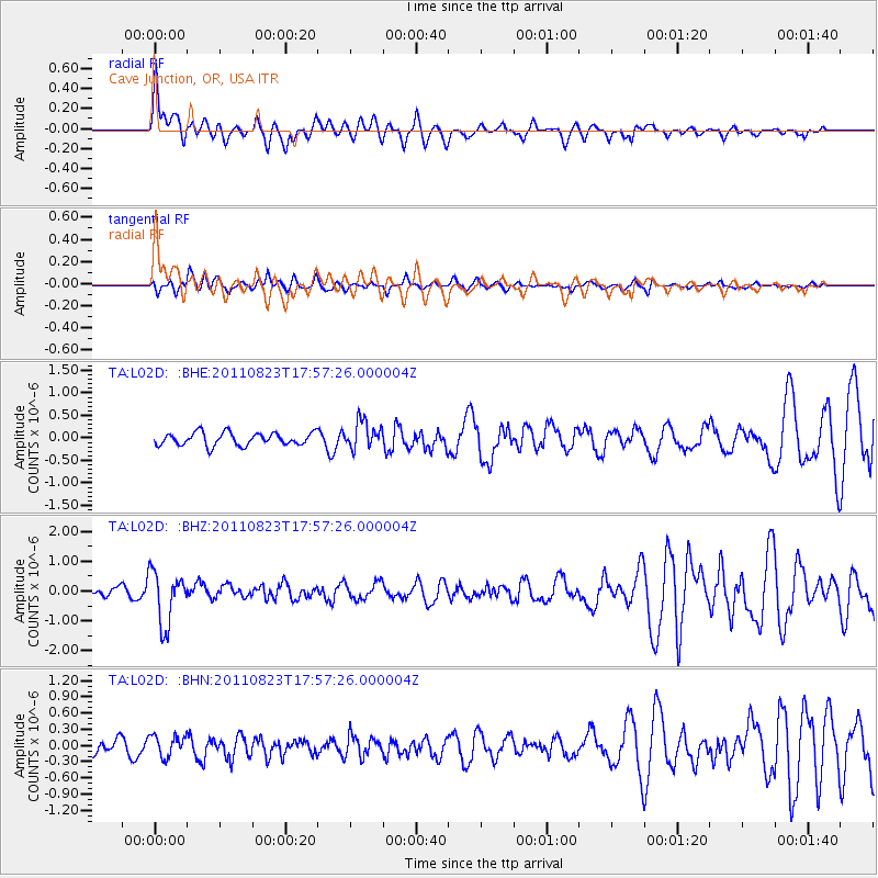
L02D Cave Junction, OR, USA - Earthquake Result Viewer
*The percent match for this event was below the threshold and hence no stack was calculated.
| Earthquake location: |
Virginia |
| Earthquake latitude/longitude: |
37.9/-77.9 |
| Earthquake time(UTC): |
2011/08/23 (235) 17:51:04 GMT |
| Earthquake Depth: |
6.0 km |
| Earthquake Magnitude: |
5.9 MB, 5.6 MS, 5.8 MW, 5.8 MW |
| Earthquake Catalog/Contributor: |
WHDF/NEIC |
|
| Network: |
TA USArray Transportable Network (new EarthScope stations) |
| Station: |
L02D Cave Junction, OR, USA |
| Lat/Lon: |
42.16 N/123.60 W |
| Elevation: |
458 m |
|
| Distance: |
34.9 deg |
| Az: |
291.606 deg |
| Baz: |
81.381 deg |
| Ray Param: |
$rayparam |
*The percent match for this event was below the threshold and hence was not used in the summary stack. |
|
| Radial Match: |
51.23855 % |
| Radial Bump: |
400 |
| Transverse Match: |
51.15836 % |
| Transverse Bump: |
400 |
| SOD ConfigId: |
414626 |
| Insert Time: |
2012-01-13 07:07:42.357 +0000 |
| GWidth: |
2.5 |
| Max Bumps: |
400 |
| Tol: |
0.001 |
|
Signal To Noise
| Channel | StoN | STA | LTA |
| TA:L02D: :BHZ:20110823T17:57:26.000004Z | 4.8929486 | 8.87686E-7 | 1.8142147E-7 |
| TA:L02D: :BHN:20110823T17:57:26.000004Z | 1.42442 | 1.993104E-7 | 1.3992391E-7 |
| TA:L02D: :BHE:20110823T17:57:26.000004Z | 2.1731205 | 3.072433E-7 | 1.4138347E-7 |
| Arrivals |
| Ps | |
| PpPs | |
| PsPs/PpSs | |


