You are here: Home > Network List > TA - USArray Transportable Network (new EarthScope stations) Stations List
> Station O03D Paynes Creek, CA, USA > Earthquake Result Viewer
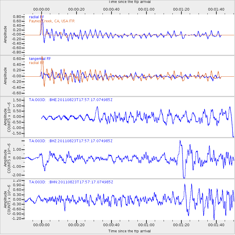
O03D Paynes Creek, CA, USA - Earthquake Result Viewer
*The percent match for this event was below the threshold and hence no stack was calculated.
| Earthquake location: |
Virginia |
| Earthquake latitude/longitude: |
37.9/-77.9 |
| Earthquake time(UTC): |
2011/08/23 (235) 17:51:04 GMT |
| Earthquake Depth: |
6.0 km |
| Earthquake Magnitude: |
5.9 MB, 5.6 MS, 5.8 MW, 5.8 MW |
| Earthquake Catalog/Contributor: |
WHDF/NEIC |
|
| Network: |
TA USArray Transportable Network (new EarthScope stations) |
| Station: |
O03D Paynes Creek, CA, USA |
| Lat/Lon: |
40.29 N/121.80 W |
| Elevation: |
968 m |
|
| Distance: |
33.9 deg |
| Az: |
287.956 deg |
| Baz: |
79.551 deg |
| Ray Param: |
$rayparam |
*The percent match for this event was below the threshold and hence was not used in the summary stack. |
|
| Radial Match: |
62.414192 % |
| Radial Bump: |
400 |
| Transverse Match: |
64.502235 % |
| Transverse Bump: |
400 |
| SOD ConfigId: |
414626 |
| Insert Time: |
2012-01-13 07:07:54.744 +0000 |
| GWidth: |
2.5 |
| Max Bumps: |
400 |
| Tol: |
0.001 |
|
Signal To Noise
| Channel | StoN | STA | LTA |
| TA:O03D: :BHZ:20110823T17:57:17.074985Z | 7.968003 | 6.833642E-7 | 8.5763546E-8 |
| TA:O03D: :BHN:20110823T17:57:17.074985Z | 0.78324735 | 9.943051E-8 | 1.2694649E-7 |
| TA:O03D: :BHE:20110823T17:57:17.074985Z | 3.8186634 | 4.4790363E-7 | 1.17293304E-7 |
| Arrivals |
| Ps | |
| PpPs | |
| PsPs/PpSs | |


