You are here: Home > Network List > US - United States National Seismic Network Stations List
> Station HAWA Hanford, Washington, USA > Earthquake Result Viewer
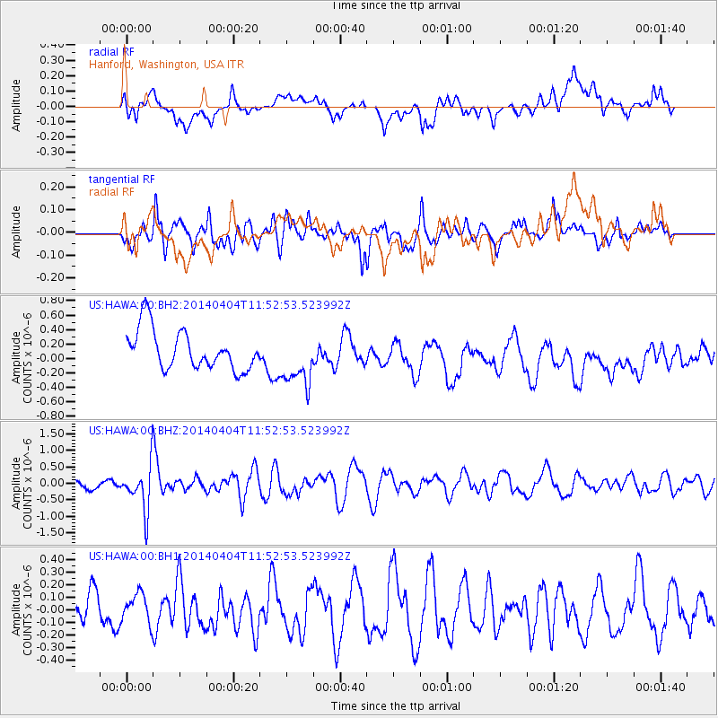
HAWA Hanford, Washington, USA - Earthquake Result Viewer
*The percent match for this event was below the threshold and hence no stack was calculated.
| Earthquake location: |
Solomon Islands |
| Earthquake latitude/longitude: |
-10.5/161.7 |
| Earthquake time(UTC): |
2014/04/04 (094) 11:40:32 GMT |
| Earthquake Depth: |
64 km |
| Earthquake Magnitude: |
6.0 MB, 6.0 MWC, 6.0 MWW, 6.0 MWB |
| Earthquake Catalog/Contributor: |
NEIC PDE/NEIC COMCAT |
|
| Network: |
US United States National Seismic Network |
| Station: |
HAWA Hanford, Washington, USA |
| Lat/Lon: |
46.39 N/119.53 W |
| Elevation: |
364 m |
|
| Distance: |
89.9 deg |
| Az: |
42.761 deg |
| Baz: |
254.717 deg |
| Ray Param: |
$rayparam |
*The percent match for this event was below the threshold and hence was not used in the summary stack. |
|
| Radial Match: |
43.706913 % |
| Radial Bump: |
400 |
| Transverse Match: |
57.08141 % |
| Transverse Bump: |
400 |
| SOD ConfigId: |
3390531 |
| Insert Time: |
2019-04-11 03:41:45.093 +0000 |
| GWidth: |
2.5 |
| Max Bumps: |
400 |
| Tol: |
0.001 |
|
Signal To Noise
| Channel | StoN | STA | LTA |
| US:HAWA:00:BHZ:20140404T11:52:53.523992Z | 3.4666212 | 6.925635E-7 | 1.9978056E-7 |
| US:HAWA:00:BH1:20140404T11:52:53.523992Z | 0.8743233 | 1.17116464E-7 | 1.3395098E-7 |
| US:HAWA:00:BH2:20140404T11:52:53.523992Z | 1.3408921 | 3.6741224E-7 | 2.7400583E-7 |
| Arrivals |
| Ps | |
| PpPs | |
| PsPs/PpSs | |


