You are here: Home > Network List > TA - USArray Transportable Network (new EarthScope stations) Stations List
> Station 635A Leesville, TX, USA > Earthquake Result Viewer
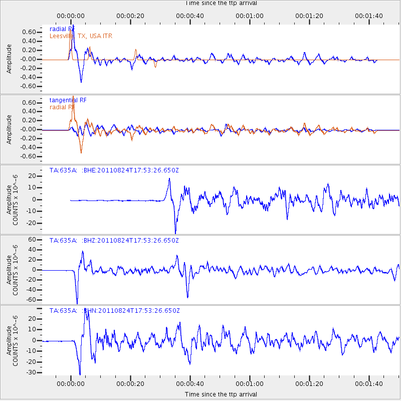
635A Leesville, TX, USA - Earthquake Result Viewer

| Earthquake location: |
Peru-Brazil Border Region |
| Earthquake latitude/longitude: |
-7.6/-74.5 |
| Earthquake time(UTC): |
2011/08/24 (236) 17:46:11 GMT |
| Earthquake Depth: |
147 km |
| Earthquake Magnitude: |
6.8 MB, 7.0 MW, 7.0 MW |
| Earthquake Catalog/Contributor: |
WHDF/NEIC |
|
| Network: |
TA USArray Transportable Network (new EarthScope stations) |
| Station: |
635A Leesville, TX, USA |
| Lat/Lon: |
29.39 N/97.77 W |
| Elevation: |
119 m |
|
| Distance: |
43.1 deg |
| Az: |
329.715 deg |
| Baz: |
145.055 deg |
| Ray Param: |
0.07222118 |
| Estimated Moho Depth: |
32.75 km |
| Estimated Crust Vp/Vs: |
1.86 |
| Assumed Crust Vp: |
5.78 km/s |
| Estimated Crust Vs: |
3.112 km/s |
| Estimated Crust Poisson's Ratio: |
0.30 |
|
| Radial Match: |
96.28997 % |
| Radial Bump: |
362 |
| Transverse Match: |
90.21562 % |
| Transverse Bump: |
400 |
| SOD ConfigId: |
414626 |
| Insert Time: |
2012-01-13 07:35:41.496 +0000 |
| GWidth: |
2.5 |
| Max Bumps: |
400 |
| Tol: |
0.001 |
|
Signal To Noise
| Channel | StoN | STA | LTA |
| TA:635A: :BHZ:20110824T17:53:26.650Z | 281.86224 | 2.4388137E-5 | 8.652502E-8 |
| TA:635A: :BHN:20110824T17:53:26.650Z | 74.92482 | 1.2913867E-5 | 1.7235767E-7 |
| TA:635A: :BHE:20110824T17:53:26.650Z | 38.155407 | 6.8200675E-6 | 1.7874446E-7 |
| Arrivals |
| Ps | 5.1 SECOND |
| PpPs | 15 SECOND |
| PsPs/PpSs | 21 SECOND |


