You are here: Home > Network List > TA - USArray Transportable Network (new EarthScope stations) Stations List
> Station Y37A Hugo, OK, USA > Earthquake Result Viewer
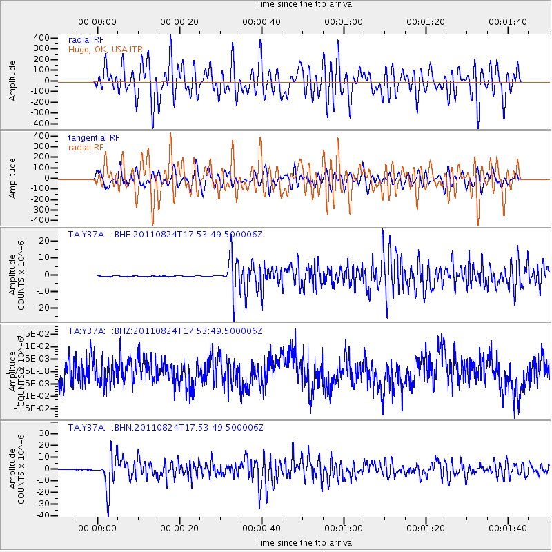
Y37A Hugo, OK, USA - Earthquake Result Viewer
*The percent match for this event was below the threshold and hence no stack was calculated.
| Earthquake location: |
Peru-Brazil Border Region |
| Earthquake latitude/longitude: |
-7.6/-74.5 |
| Earthquake time(UTC): |
2011/08/24 (236) 17:46:11 GMT |
| Earthquake Depth: |
147 km |
| Earthquake Magnitude: |
6.8 MB, 7.0 MW, 7.0 MW |
| Earthquake Catalog/Contributor: |
WHDF/NEIC |
|
| Network: |
TA USArray Transportable Network (new EarthScope stations) |
| Station: |
Y37A Hugo, OK, USA |
| Lat/Lon: |
33.98 N/95.62 W |
| Elevation: |
165 m |
|
| Distance: |
46.0 deg |
| Az: |
335.419 deg |
| Baz: |
150.25 deg |
| Ray Param: |
$rayparam |
*The percent match for this event was below the threshold and hence was not used in the summary stack. |
|
| Radial Match: |
44.93316 % |
| Radial Bump: |
400 |
| Transverse Match: |
47.785 % |
| Transverse Bump: |
400 |
| SOD ConfigId: |
414626 |
| Insert Time: |
2012-01-13 07:39:31.180 +0000 |
| GWidth: |
2.5 |
| Max Bumps: |
400 |
| Tol: |
0.001 |
|
Signal To Noise
| Channel | StoN | STA | LTA |
| TA:Y37A: :BHZ:20110824T17:53:49.500006Z | 0.93323106 | 4.347442E-9 | 4.6584843E-9 |
| TA:Y37A: :BHN:20110824T17:53:49.500006Z | 94.60551 | 1.4449763E-5 | 1.5273702E-7 |
| TA:Y37A: :BHE:20110824T17:53:49.500006Z | 57.965252 | 1.045691E-5 | 1.8039964E-7 |
| Arrivals |
| Ps | |
| PpPs | |
| PsPs/PpSs | |


