You are here: Home > Network List > TA - USArray Transportable Network (new EarthScope stations) Stations List
> Station J34A George, IA, USA > Earthquake Result Viewer
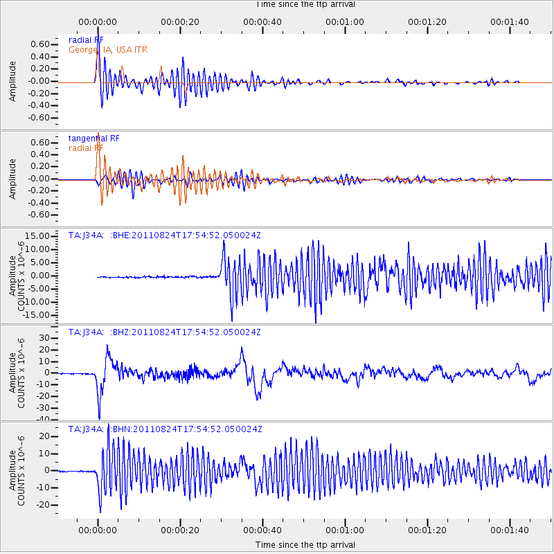
J34A George, IA, USA - Earthquake Result Viewer
*The percent match for this event was below the threshold and hence no stack was calculated.
| Earthquake location: |
Peru-Brazil Border Region |
| Earthquake latitude/longitude: |
-7.6/-74.5 |
| Earthquake time(UTC): |
2011/08/24 (236) 17:46:11 GMT |
| Earthquake Depth: |
147 km |
| Earthquake Magnitude: |
6.8 MB, 7.0 MW, 7.0 MW |
| Earthquake Catalog/Contributor: |
WHDF/NEIC |
|
| Network: |
TA USArray Transportable Network (new EarthScope stations) |
| Station: |
J34A George, IA, USA |
| Lat/Lon: |
43.28 N/95.96 W |
| Elevation: |
432 m |
|
| Distance: |
54.3 deg |
| Az: |
340.817 deg |
| Baz: |
153.511 deg |
| Ray Param: |
$rayparam |
*The percent match for this event was below the threshold and hence was not used in the summary stack. |
|
| Radial Match: |
72.35211 % |
| Radial Bump: |
400 |
| Transverse Match: |
61.988697 % |
| Transverse Bump: |
400 |
| SOD ConfigId: |
414626 |
| Insert Time: |
2012-01-13 07:44:44.490 +0000 |
| GWidth: |
2.5 |
| Max Bumps: |
400 |
| Tol: |
0.001 |
|
Signal To Noise
| Channel | StoN | STA | LTA |
| TA:J34A: :BHZ:20110824T17:54:52.050024Z | 114.454315 | 1.5320986E-5 | 1.3386115E-7 |
| TA:J34A: :BHN:20110824T17:54:52.050024Z | 70.07225 | 1.2483367E-5 | 1.7814993E-7 |
| TA:J34A: :BHE:20110824T17:54:52.050024Z | 40.69266 | 7.0078195E-6 | 1.7221336E-7 |
| Arrivals |
| Ps | |
| PpPs | |
| PsPs/PpSs | |


