You are here: Home > Network List > TA - USArray Transportable Network (new EarthScope stations) Stations List
> Station 242A Grayson, LA, USA > Earthquake Result Viewer
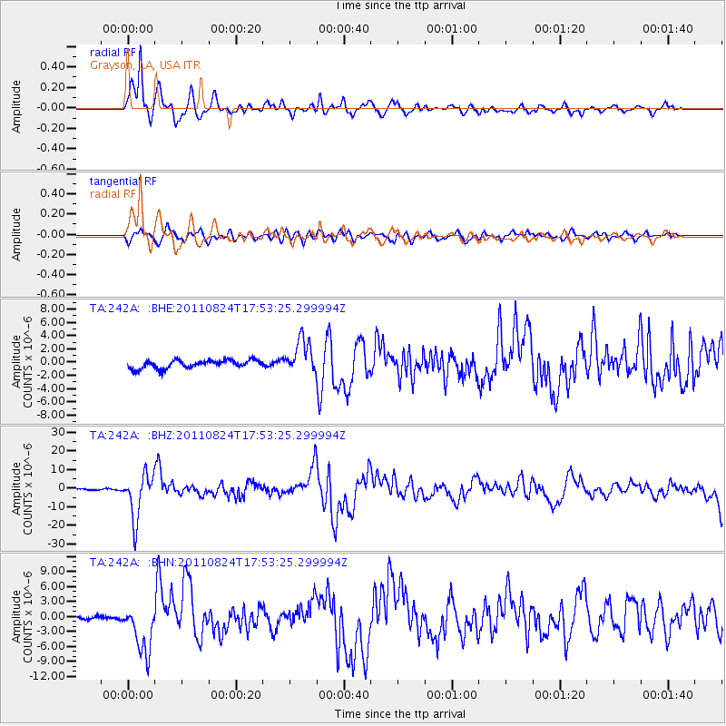
242A Grayson, LA, USA - Earthquake Result Viewer
*The percent match for this event was below the threshold and hence no stack was calculated.
| Earthquake location: |
Peru-Brazil Border Region |
| Earthquake latitude/longitude: |
-7.6/-74.5 |
| Earthquake time(UTC): |
2011/08/24 (236) 17:46:11 GMT |
| Earthquake Depth: |
147 km |
| Earthquake Magnitude: |
6.8 MB, 7.0 MW, 7.0 MW |
| Earthquake Catalog/Contributor: |
WHDF/NEIC |
|
| Network: |
TA USArray Transportable Network (new EarthScope stations) |
| Station: |
242A Grayson, LA, USA |
| Lat/Lon: |
32.06 N/92.15 W |
| Elevation: |
57 m |
|
| Distance: |
42.9 deg |
| Az: |
337.815 deg |
| Baz: |
153.844 deg |
| Ray Param: |
$rayparam |
*The percent match for this event was below the threshold and hence was not used in the summary stack. |
|
| Radial Match: |
91.19422 % |
| Radial Bump: |
400 |
| Transverse Match: |
71.719406 % |
| Transverse Bump: |
400 |
| SOD ConfigId: |
414626 |
| Insert Time: |
2012-01-13 07:55:34.170 +0000 |
| GWidth: |
2.5 |
| Max Bumps: |
400 |
| Tol: |
0.001 |
|
Signal To Noise
| Channel | StoN | STA | LTA |
| TA:242A: :BHZ:20110824T17:53:25.299994Z | 49.93876 | 1.2106293E-5 | 2.424228E-7 |
| TA:242A: :BHN:20110824T17:53:25.299994Z | 15.436224 | 4.9645205E-6 | 3.2161498E-7 |
| TA:242A: :BHE:20110824T17:53:25.299994Z | 4.209848 | 2.6105772E-6 | 6.2011196E-7 |
| Arrivals |
| Ps | |
| PpPs | |
| PsPs/PpSs | |


