You are here: Home > Network List > TA - USArray Transportable Network (new EarthScope stations) Stations List
> Station H39A Augusta, WI, USA > Earthquake Result Viewer
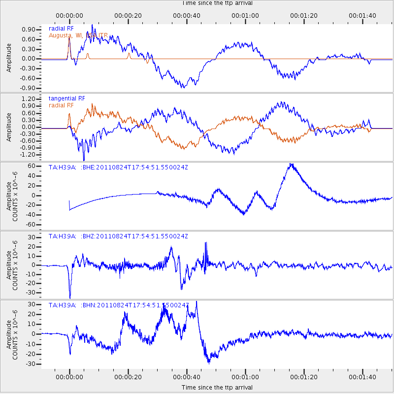
H39A Augusta, WI, USA - Earthquake Result Viewer
*The percent match for this event was below the threshold and hence no stack was calculated.
| Earthquake location: |
Peru-Brazil Border Region |
| Earthquake latitude/longitude: |
-7.6/-74.5 |
| Earthquake time(UTC): |
2011/08/24 (236) 17:46:11 GMT |
| Earthquake Depth: |
147 km |
| Earthquake Magnitude: |
6.8 MB, 7.0 MW, 7.0 MW |
| Earthquake Catalog/Contributor: |
WHDF/NEIC |
|
| Network: |
TA USArray Transportable Network (new EarthScope stations) |
| Station: |
H39A Augusta, WI, USA |
| Lat/Lon: |
44.68 N/91.28 W |
| Elevation: |
345 m |
|
| Distance: |
54.2 deg |
| Az: |
345.314 deg |
| Baz: |
159.374 deg |
| Ray Param: |
$rayparam |
*The percent match for this event was below the threshold and hence was not used in the summary stack. |
|
| Radial Match: |
63.861923 % |
| Radial Bump: |
400 |
| Transverse Match: |
63.77834 % |
| Transverse Bump: |
400 |
| SOD ConfigId: |
414626 |
| Insert Time: |
2012-01-13 08:30:01.614 +0000 |
| GWidth: |
2.5 |
| Max Bumps: |
400 |
| Tol: |
0.001 |
|
Signal To Noise
| Channel | StoN | STA | LTA |
| TA:H39A: :BHZ:20110824T17:54:51.550024Z | 53.355446 | 1.1948688E-5 | 2.2394504E-7 |
| TA:H39A: :BHN:20110824T17:54:51.550024Z | 2.3798614 | 6.2422887E-6 | 2.6229634E-6 |
| TA:H39A: :BHE:20110824T17:54:51.550024Z | 1.1130545 | 1.0601321E-5 | 9.5245305E-6 |
| Arrivals |
| Ps | |
| PpPs | |
| PsPs/PpSs | |


