You are here: Home > Network List > TA - USArray Transportable Network (new EarthScope stations) Stations List
> Station G05D Wamic, OR, USA > Earthquake Result Viewer
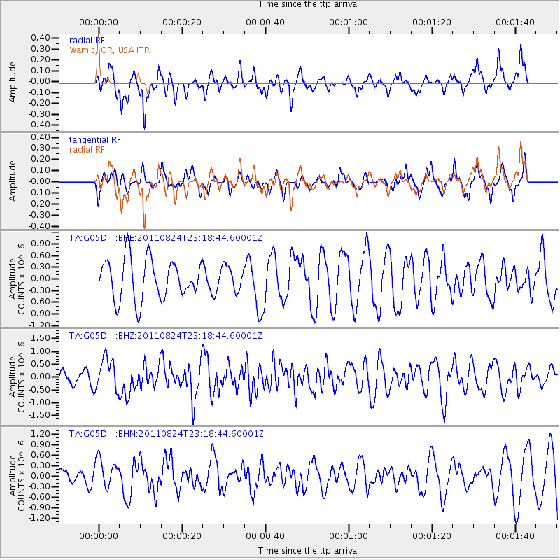
G05D Wamic, OR, USA - Earthquake Result Viewer
*The percent match for this event was below the threshold and hence no stack was calculated.
| Earthquake location: |
Vanuatu Islands |
| Earthquake latitude/longitude: |
-18.2/167.7 |
| Earthquake time(UTC): |
2011/08/24 (236) 23:06:17 GMT |
| Earthquake Depth: |
13 km |
| Earthquake Magnitude: |
5.7 MB, 6.0 MS, 6.2 MW, 6.1 MW |
| Earthquake Catalog/Contributor: |
WHDF/NEIC |
|
| Network: |
TA USArray Transportable Network (new EarthScope stations) |
| Station: |
G05D Wamic, OR, USA |
| Lat/Lon: |
45.24 N/121.32 W |
| Elevation: |
592 m |
|
| Distance: |
90.0 deg |
| Az: |
41.899 deg |
| Baz: |
244.0 deg |
| Ray Param: |
$rayparam |
*The percent match for this event was below the threshold and hence was not used in the summary stack. |
|
| Radial Match: |
70.540474 % |
| Radial Bump: |
370 |
| Transverse Match: |
51.270584 % |
| Transverse Bump: |
331 |
| SOD ConfigId: |
414626 |
| Insert Time: |
2012-01-13 09:02:35.508 +0000 |
| GWidth: |
2.5 |
| Max Bumps: |
400 |
| Tol: |
0.001 |
|
Signal To Noise
| Channel | StoN | STA | LTA |
| TA:G05D: :BHZ:20110824T23:18:44.60001Z | 2.5137532 | 6.4136384E-7 | 2.551419E-7 |
| TA:G05D: :BHN:20110824T23:18:44.60001Z | 1.1311463 | 4.0773617E-7 | 3.604628E-7 |
| TA:G05D: :BHE:20110824T23:18:44.60001Z | 0.58414644 | 3.0265977E-7 | 5.181231E-7 |
| Arrivals |
| Ps | |
| PpPs | |
| PsPs/PpSs | |


