You are here: Home > Network List > TA - USArray Transportable Network (new EarthScope stations) Stations List
> Station L04D Klamath Falls, OR, USA > Earthquake Result Viewer
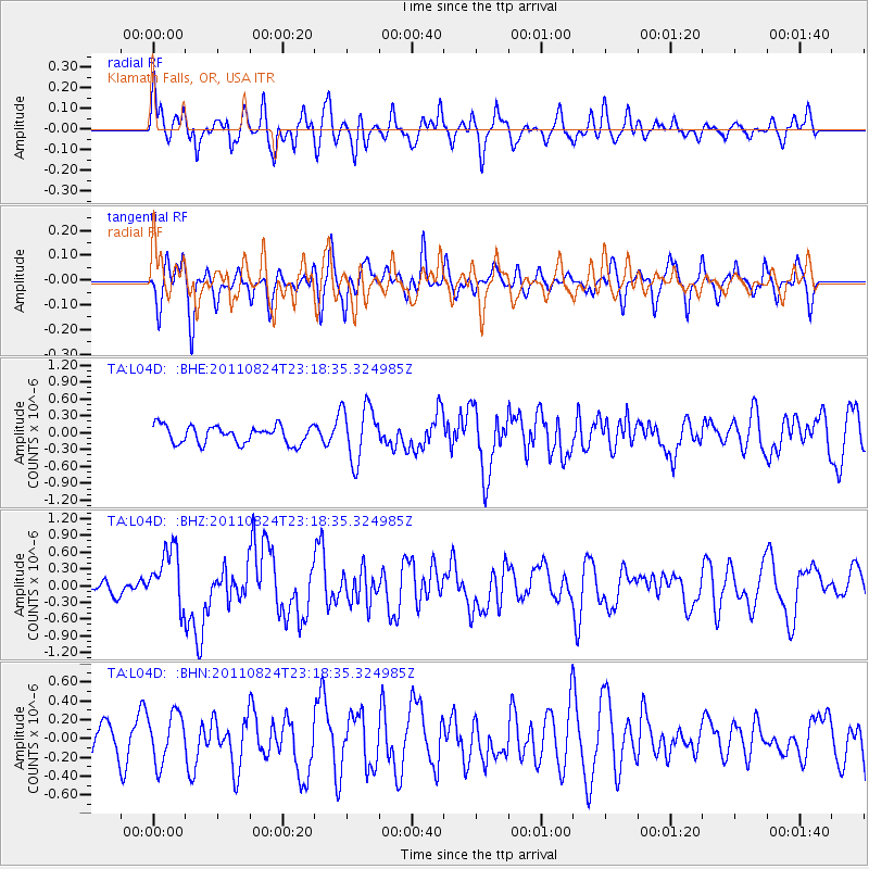
L04D Klamath Falls, OR, USA - Earthquake Result Viewer
*The percent match for this event was below the threshold and hence no stack was calculated.
| Earthquake location: |
Vanuatu Islands |
| Earthquake latitude/longitude: |
-18.2/167.7 |
| Earthquake time(UTC): |
2011/08/24 (236) 23:06:17 GMT |
| Earthquake Depth: |
13 km |
| Earthquake Magnitude: |
5.7 MB, 6.0 MS, 6.2 MW, 6.1 MW |
| Earthquake Catalog/Contributor: |
WHDF/NEIC |
|
| Network: |
TA USArray Transportable Network (new EarthScope stations) |
| Station: |
L04D Klamath Falls, OR, USA |
| Lat/Lon: |
42.22 N/122.30 W |
| Elevation: |
1437 m |
|
| Distance: |
88.0 deg |
| Az: |
44.292 deg |
| Baz: |
243.361 deg |
| Ray Param: |
$rayparam |
*The percent match for this event was below the threshold and hence was not used in the summary stack. |
|
| Radial Match: |
50.357082 % |
| Radial Bump: |
400 |
| Transverse Match: |
50.655594 % |
| Transverse Bump: |
366 |
| SOD ConfigId: |
414626 |
| Insert Time: |
2012-01-13 09:03:15.892 +0000 |
| GWidth: |
2.5 |
| Max Bumps: |
400 |
| Tol: |
0.001 |
|
Signal To Noise
| Channel | StoN | STA | LTA |
| TA:L04D: :BHZ:20110824T23:18:35.324985Z | 5.0131865 | 5.2668577E-7 | 1.0506008E-7 |
| TA:L04D: :BHN:20110824T23:18:35.324985Z | 1.0816166 | 2.592914E-7 | 2.3972578E-7 |
| TA:L04D: :BHE:20110824T23:18:35.324985Z | 3.131585 | 4.9235183E-7 | 1.5722131E-7 |
| Arrivals |
| Ps | |
| PpPs | |
| PsPs/PpSs | |


