You are here: Home > Network List > TA - USArray Transportable Network (new EarthScope stations) Stations List
> Station R11A Troy Canyon, Currant, NV, USA > Earthquake Result Viewer
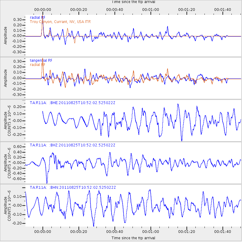
R11A Troy Canyon, Currant, NV, USA - Earthquake Result Viewer
*The percent match for this event was below the threshold and hence no stack was calculated.
| Earthquake location: |
Vanuatu Islands |
| Earthquake latitude/longitude: |
-13.6/167.0 |
| Earthquake time(UTC): |
2011/08/25 (237) 10:39:58 GMT |
| Earthquake Depth: |
159 km |
| Earthquake Magnitude: |
5.6 MB, 5.9 MW, 5.9 MW |
| Earthquake Catalog/Contributor: |
WHDF/NEIC |
|
| Network: |
TA USArray Transportable Network (new EarthScope stations) |
| Station: |
R11A Troy Canyon, Currant, NV, USA |
| Lat/Lon: |
38.35 N/115.59 W |
| Elevation: |
1756 m |
|
| Distance: |
88.7 deg |
| Az: |
50.137 deg |
| Baz: |
251.661 deg |
| Ray Param: |
$rayparam |
*The percent match for this event was below the threshold and hence was not used in the summary stack. |
|
| Radial Match: |
54.535465 % |
| Radial Bump: |
339 |
| Transverse Match: |
49.047447 % |
| Transverse Bump: |
400 |
| SOD ConfigId: |
414626 |
| Insert Time: |
2012-01-13 09:33:06.273 +0000 |
| GWidth: |
2.5 |
| Max Bumps: |
400 |
| Tol: |
0.001 |
|
Signal To Noise
| Channel | StoN | STA | LTA |
| TA:R11A: :BHZ:20110825T10:52:02.525022Z | 4.4313073 | 3.0764005E-7 | 6.942422E-8 |
| TA:R11A: :BHN:20110825T10:52:02.525022Z | 0.8831285 | 6.058823E-8 | 6.8606354E-8 |
| TA:R11A: :BHE:20110825T10:52:02.525022Z | 1.8340844 | 1.0447074E-7 | 5.6960705E-8 |
| Arrivals |
| Ps | |
| PpPs | |
| PsPs/PpSs | |


