You are here: Home > Network List > AZ - ANZA Regional Network Stations List
> Station LVA2 AZ.LVA2 > Earthquake Result Viewer
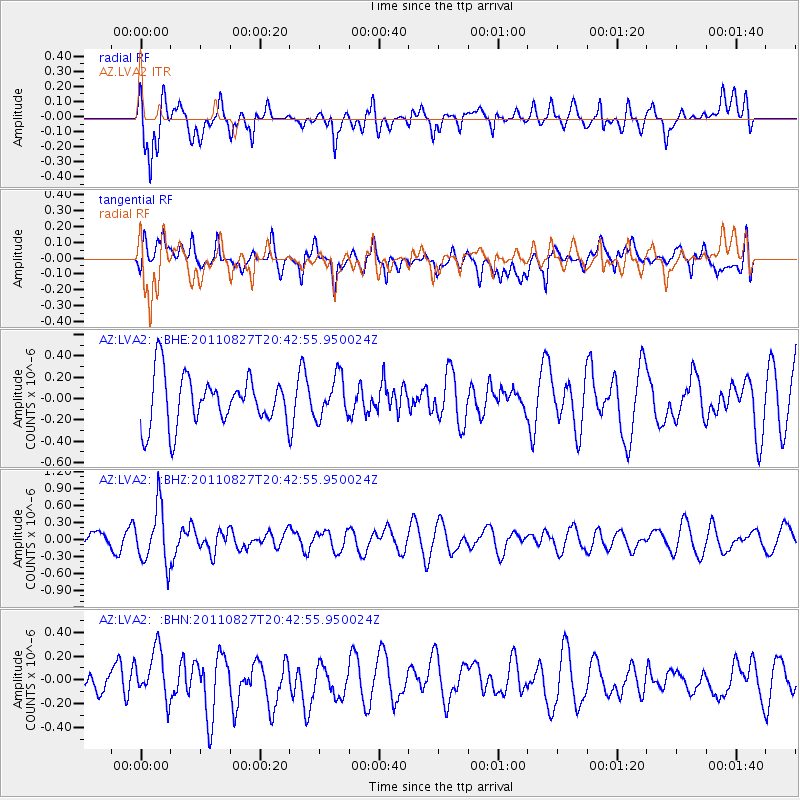
LVA2 AZ.LVA2 - Earthquake Result Viewer
*The percent match for this event was below the threshold and hence no stack was calculated.
| Earthquake location: |
South Of Fiji Islands |
| Earthquake latitude/longitude: |
-24.6/179.9 |
| Earthquake time(UTC): |
2011/08/27 (239) 20:31:53 GMT |
| Earthquake Depth: |
509 km |
| Earthquake Magnitude: |
5.7 MW, 5.1 MB |
| Earthquake Catalog/Contributor: |
WHDF/NEIC |
|
| Network: |
AZ ANZA Regional Network |
| Station: |
LVA2 AZ.LVA2 |
| Lat/Lon: |
33.35 N/116.56 W |
| Elevation: |
1435 m |
|
| Distance: |
83.5 deg |
| Az: |
48.939 deg |
| Baz: |
235.093 deg |
| Ray Param: |
$rayparam |
*The percent match for this event was below the threshold and hence was not used in the summary stack. |
|
| Radial Match: |
58.86984 % |
| Radial Bump: |
400 |
| Transverse Match: |
57.732574 % |
| Transverse Bump: |
400 |
| SOD ConfigId: |
414626 |
| Insert Time: |
2012-01-18 05:35:10.466 +0000 |
| GWidth: |
2.5 |
| Max Bumps: |
400 |
| Tol: |
0.001 |
|
Signal To Noise
| Channel | StoN | STA | LTA |
| AZ:LVA2: :BHZ:20110827T20:42:55.950024Z | 4.640503 | 5.0660293E-7 | 1.0916983E-7 |
| AZ:LVA2: :BHN:20110827T20:42:55.950024Z | 1.3949136 | 2.2201341E-7 | 1.5915926E-7 |
| AZ:LVA2: :BHE:20110827T20:42:55.950024Z | 0.82094824 | 1.9127393E-7 | 2.3299145E-7 |
| Arrivals |
| Ps | |
| PpPs | |
| PsPs/PpSs | |


