You are here: Home > Network List > CI - Caltech Regional Seismic Network Stations List
> Station GLA Glamis, Glamis, CA, USA > Earthquake Result Viewer
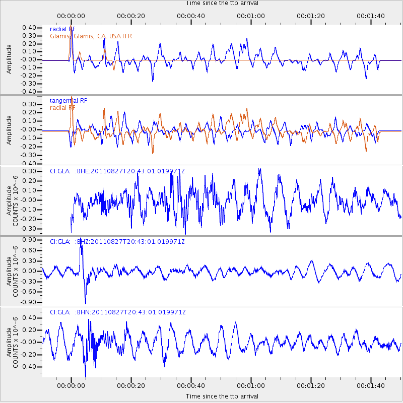
GLA Glamis, Glamis, CA, USA - Earthquake Result Viewer
*The percent match for this event was below the threshold and hence no stack was calculated.
| Earthquake location: |
South Of Fiji Islands |
| Earthquake latitude/longitude: |
-24.6/179.9 |
| Earthquake time(UTC): |
2011/08/27 (239) 20:31:53 GMT |
| Earthquake Depth: |
509 km |
| Earthquake Magnitude: |
5.7 MW, 5.1 MB |
| Earthquake Catalog/Contributor: |
WHDF/NEIC |
|
| Network: |
CI Caltech Regional Seismic Network |
| Station: |
GLA Glamis, Glamis, CA, USA |
| Lat/Lon: |
33.05 N/114.83 W |
| Elevation: |
610 m |
|
| Distance: |
84.5 deg |
| Az: |
50.013 deg |
| Baz: |
236.15 deg |
| Ray Param: |
$rayparam |
*The percent match for this event was below the threshold and hence was not used in the summary stack. |
|
| Radial Match: |
59.04362 % |
| Radial Bump: |
400 |
| Transverse Match: |
70.79209 % |
| Transverse Bump: |
332 |
| SOD ConfigId: |
414626 |
| Insert Time: |
2012-01-18 05:36:18.737 +0000 |
| GWidth: |
2.5 |
| Max Bumps: |
400 |
| Tol: |
0.001 |
|
Signal To Noise
| Channel | StoN | STA | LTA |
| CI:GLA: :BHZ:20110827T20:43:01.019971Z | 3.4731061 | 3.6910203E-7 | 1.0627433E-7 |
| CI:GLA: :BHN:20110827T20:43:01.019971Z | 1.7283376 | 1.9728542E-7 | 1.14147504E-7 |
| CI:GLA: :BHE:20110827T20:43:01.019971Z | 1.2979289 | 1.312848E-7 | 1.0114946E-7 |
| Arrivals |
| Ps | |
| PpPs | |
| PsPs/PpSs | |


