You are here: Home > Network List > CI - Caltech Regional Seismic Network Stations List
> Station MPP McPhearson Peak > Earthquake Result Viewer
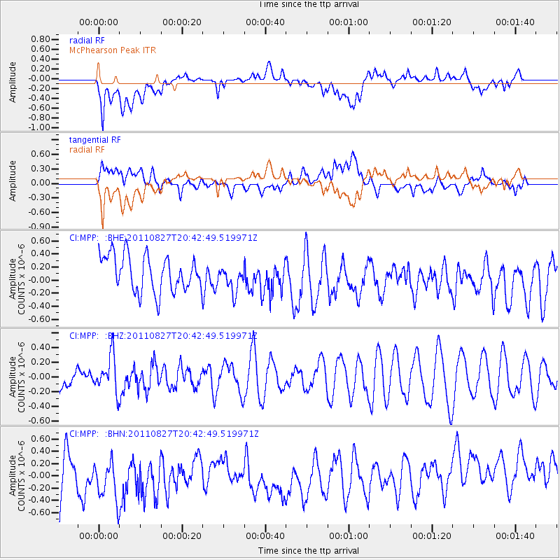
MPP McPhearson Peak - Earthquake Result Viewer
*The percent match for this event was below the threshold and hence no stack was calculated.
| Earthquake location: |
South Of Fiji Islands |
| Earthquake latitude/longitude: |
-24.6/179.9 |
| Earthquake time(UTC): |
2011/08/27 (239) 20:31:53 GMT |
| Earthquake Depth: |
509 km |
| Earthquake Magnitude: |
5.7 MW, 5.1 MB |
| Earthquake Catalog/Contributor: |
WHDF/NEIC |
|
| Network: |
CI Caltech Regional Seismic Network |
| Station: |
MPP McPhearson Peak |
| Lat/Lon: |
34.89 N/119.81 W |
| Elevation: |
1739 m |
|
| Distance: |
82.2 deg |
| Az: |
46.092 deg |
| Baz: |
232.922 deg |
| Ray Param: |
$rayparam |
*The percent match for this event was below the threshold and hence was not used in the summary stack. |
|
| Radial Match: |
49.124584 % |
| Radial Bump: |
400 |
| Transverse Match: |
45.673046 % |
| Transverse Bump: |
400 |
| SOD ConfigId: |
414626 |
| Insert Time: |
2012-01-18 05:38:04.845 +0000 |
| GWidth: |
2.5 |
| Max Bumps: |
400 |
| Tol: |
0.001 |
|
Signal To Noise
| Channel | StoN | STA | LTA |
| CI:MPP: :BHZ:20110827T20:42:49.519971Z | 1.3587652 | 2.5565586E-7 | 1.8815308E-7 |
| CI:MPP: :BHN:20110827T20:42:49.519971Z | 0.87472224 | 6.265743E-7 | 7.163123E-7 |
| CI:MPP: :BHE:20110827T20:42:49.519971Z | 0.74642295 | 2.0504679E-7 | 2.747059E-7 |
| Arrivals |
| Ps | |
| PpPs | |
| PsPs/PpSs | |


