You are here: Home > Network List > CI - Caltech Regional Seismic Network Stations List
> Station BFS Mt Baldy Forest Station > Earthquake Result Viewer
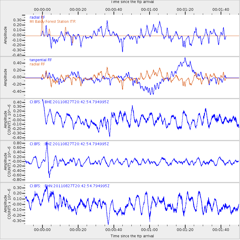
BFS Mt Baldy Forest Station - Earthquake Result Viewer
*The percent match for this event was below the threshold and hence no stack was calculated.
| Earthquake location: |
South Of Fiji Islands |
| Earthquake latitude/longitude: |
-24.6/179.9 |
| Earthquake time(UTC): |
2011/08/27 (239) 20:31:53 GMT |
| Earthquake Depth: |
509 km |
| Earthquake Magnitude: |
5.7 MW, 5.1 MB |
| Earthquake Catalog/Contributor: |
WHDF/NEIC |
|
| Network: |
CI Caltech Regional Seismic Network |
| Station: |
BFS Mt Baldy Forest Station |
| Lat/Lon: |
34.24 N/117.66 W |
| Elevation: |
1312 m |
|
| Distance: |
83.3 deg |
| Az: |
47.681 deg |
| Baz: |
234.34 deg |
| Ray Param: |
$rayparam |
*The percent match for this event was below the threshold and hence was not used in the summary stack. |
|
| Radial Match: |
53.89963 % |
| Radial Bump: |
400 |
| Transverse Match: |
35.911175 % |
| Transverse Bump: |
400 |
| SOD ConfigId: |
414626 |
| Insert Time: |
2012-01-18 05:38:20.186 +0000 |
| GWidth: |
2.5 |
| Max Bumps: |
400 |
| Tol: |
0.001 |
|
Signal To Noise
| Channel | StoN | STA | LTA |
| CI:BFS: :BHZ:20110827T20:42:54.794995Z | 5.317668 | 3.7291673E-7 | 7.012787E-8 |
| CI:BFS: :BHN:20110827T20:42:54.794995Z | 2.0361972 | 3.3680286E-7 | 1.6540778E-7 |
| CI:BFS: :BHE:20110827T20:42:54.794995Z | 1.382761 | 1.7256605E-7 | 1.2479816E-7 |
| Arrivals |
| Ps | |
| PpPs | |
| PsPs/PpSs | |


