You are here: Home > Network List > IC - New China Digital Seismograph Network Stations List
> Station ENH Enshi, Hubei Province, China > Earthquake Result Viewer
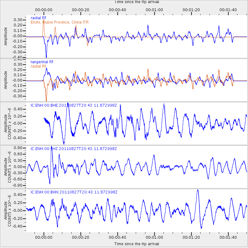
ENH Enshi, Hubei Province, China - Earthquake Result Viewer
*The percent match for this event was below the threshold and hence no stack was calculated.
| Earthquake location: |
South Of Fiji Islands |
| Earthquake latitude/longitude: |
-24.6/179.9 |
| Earthquake time(UTC): |
2011/08/27 (239) 20:31:53 GMT |
| Earthquake Depth: |
509 km |
| Earthquake Magnitude: |
5.7 MW, 5.1 MB |
| Earthquake Catalog/Contributor: |
WHDF/NEIC |
|
| Network: |
IC New China Digital Seismograph Network |
| Station: |
ENH Enshi, Hubei Province, China |
| Lat/Lon: |
30.28 N/109.49 E |
| Elevation: |
500 m |
|
| Distance: |
86.8 deg |
| Az: |
305.275 deg |
| Baz: |
120.784 deg |
| Ray Param: |
$rayparam |
*The percent match for this event was below the threshold and hence was not used in the summary stack. |
|
| Radial Match: |
53.764286 % |
| Radial Bump: |
348 |
| Transverse Match: |
48.614918 % |
| Transverse Bump: |
325 |
| SOD ConfigId: |
414626 |
| Insert Time: |
2012-01-18 05:39:31.467 +0000 |
| GWidth: |
2.5 |
| Max Bumps: |
400 |
| Tol: |
0.001 |
|
Signal To Noise
| Channel | StoN | STA | LTA |
| IC:ENH:00:BHZ:20110827T20:43:11.872998Z | 2.0047438 | 4.2492792E-7 | 2.1196121E-7 |
| IC:ENH:00:BHN:20110827T20:43:11.872998Z | 1.3988582 | 1.583318E-7 | 1.1318646E-7 |
| IC:ENH:00:BHE:20110827T20:43:11.872998Z | 0.53631157 | 1.2788999E-7 | 2.3846212E-7 |
| Arrivals |
| Ps | |
| PpPs | |
| PsPs/PpSs | |


