You are here: Home > Network List > TA - USArray Transportable Network (new EarthScope stations) Stations List
> Station G59A Clarenceville, QC, USA > Earthquake Result Viewer
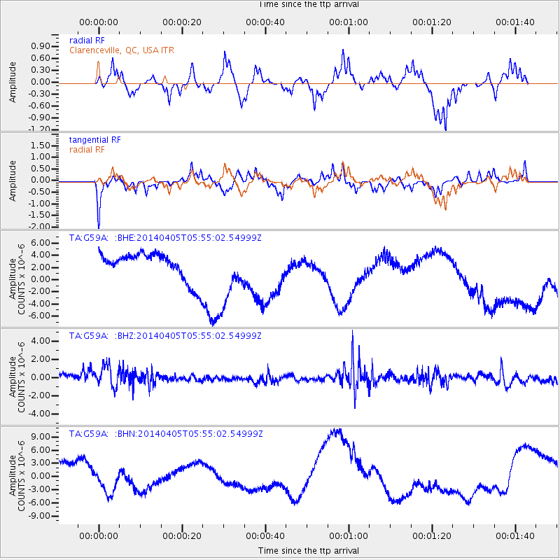
G59A Clarenceville, QC, USA - Earthquake Result Viewer
*The percent match for this event was below the threshold and hence no stack was calculated.
| Earthquake location: |
Near Coast Of Northern Chile |
| Earthquake latitude/longitude: |
-20.1/-70.5 |
| Earthquake time(UTC): |
2014/04/05 (095) 05:44:57 GMT |
| Earthquake Depth: |
39 km |
| Earthquake Magnitude: |
5.3 MW |
| Earthquake Catalog/Contributor: |
ISC/ISC |
|
| Network: |
TA USArray Transportable Network (new EarthScope stations) |
| Station: |
G59A Clarenceville, QC, USA |
| Lat/Lon: |
45.08 N/73.18 W |
| Elevation: |
36 m |
|
| Distance: |
65.0 deg |
| Az: |
357.907 deg |
| Baz: |
177.224 deg |
| Ray Param: |
$rayparam |
*The percent match for this event was below the threshold and hence was not used in the summary stack. |
|
| Radial Match: |
64.49 % |
| Radial Bump: |
288 |
| Transverse Match: |
56.00117 % |
| Transverse Bump: |
284 |
| SOD ConfigId: |
3390531 |
| Insert Time: |
2019-04-11 04:11:42.825 +0000 |
| GWidth: |
2.5 |
| Max Bumps: |
400 |
| Tol: |
0.001 |
|
Signal To Noise
| Channel | StoN | STA | LTA |
| TA:G59A: :BHZ:20140405T05:55:02.54999Z | 1.2553291 | 1.5730826E-6 | 1.2531236E-6 |
| TA:G59A: :BHN:20140405T05:55:02.54999Z | 0.7551393 | 2.470884E-6 | 3.2720902E-6 |
| TA:G59A: :BHE:20140405T05:55:02.54999Z | 2.1207845 | 4.870369E-6 | 2.2964941E-6 |
| Arrivals |
| Ps | |
| PpPs | |
| PsPs/PpSs | |


