You are here: Home > Network List > TA - USArray Transportable Network (new EarthScope stations) Stations List
> Station J05D Fort Rock, OR, USA > Earthquake Result Viewer
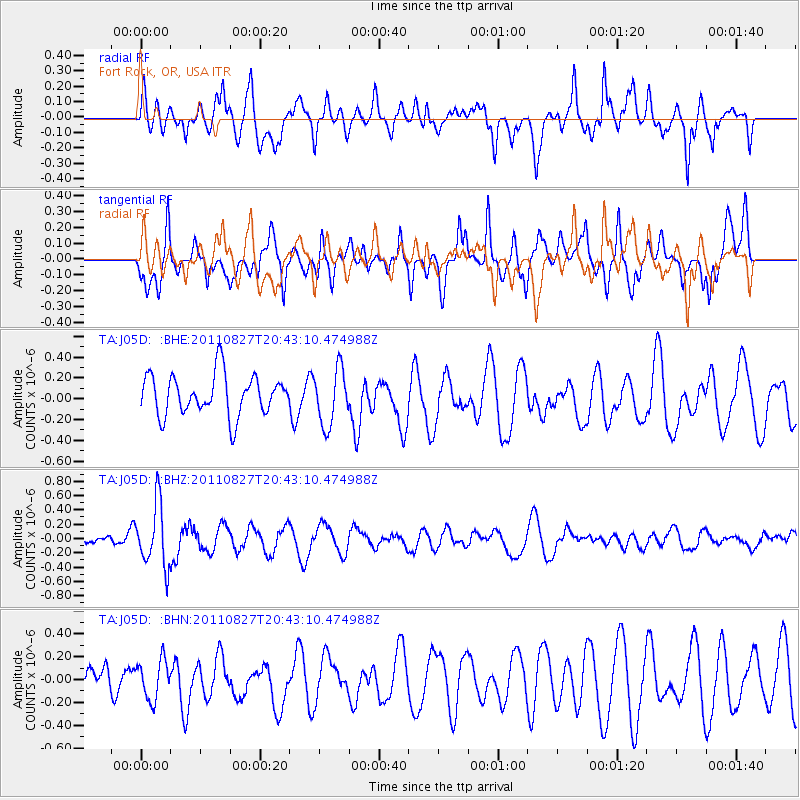
J05D Fort Rock, OR, USA - Earthquake Result Viewer
*The percent match for this event was below the threshold and hence no stack was calculated.
| Earthquake location: |
South Of Fiji Islands |
| Earthquake latitude/longitude: |
-24.6/179.9 |
| Earthquake time(UTC): |
2011/08/27 (239) 20:31:53 GMT |
| Earthquake Depth: |
509 km |
| Earthquake Magnitude: |
5.7 MW, 5.1 MB |
| Earthquake Catalog/Contributor: |
WHDF/NEIC |
|
| Network: |
TA USArray Transportable Network (new EarthScope stations) |
| Station: |
J05D Fort Rock, OR, USA |
| Lat/Lon: |
43.28 N/121.23 W |
| Elevation: |
1541 m |
|
| Distance: |
86.5 deg |
| Az: |
38.761 deg |
| Baz: |
231.304 deg |
| Ray Param: |
$rayparam |
*The percent match for this event was below the threshold and hence was not used in the summary stack. |
|
| Radial Match: |
64.71857 % |
| Radial Bump: |
400 |
| Transverse Match: |
51.04005 % |
| Transverse Bump: |
400 |
| SOD ConfigId: |
414626 |
| Insert Time: |
2012-01-18 05:41:56.937 +0000 |
| GWidth: |
2.5 |
| Max Bumps: |
400 |
| Tol: |
0.001 |
|
Signal To Noise
| Channel | StoN | STA | LTA |
| TA:J05D: :BHZ:20110827T20:43:10.474988Z | 5.114272 | 4.3763703E-7 | 8.5571706E-8 |
| TA:J05D: :BHN:20110827T20:43:10.474988Z | 0.7859115 | 1.7080492E-7 | 2.1733354E-7 |
| TA:J05D: :BHE:20110827T20:43:10.474988Z | 1.3834543 | 2.6967444E-7 | 1.9492833E-7 |
| Arrivals |
| Ps | |
| PpPs | |
| PsPs/PpSs | |


