You are here: Home > Network List > TA - USArray Transportable Network (new EarthScope stations) Stations List
> Station TPFO Pinon Flats, CA, USA > Earthquake Result Viewer
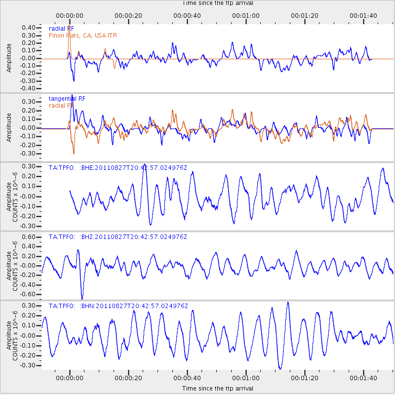
TPFO Pinon Flats, CA, USA - Earthquake Result Viewer
*The percent match for this event was below the threshold and hence no stack was calculated.
| Earthquake location: |
South Of Fiji Islands |
| Earthquake latitude/longitude: |
-24.6/179.9 |
| Earthquake time(UTC): |
2011/08/27 (239) 20:31:53 GMT |
| Earthquake Depth: |
509 km |
| Earthquake Magnitude: |
5.7 MW, 5.1 MB |
| Earthquake Catalog/Contributor: |
WHDF/NEIC |
|
| Network: |
TA USArray Transportable Network (new EarthScope stations) |
| Station: |
TPFO Pinon Flats, CA, USA |
| Lat/Lon: |
33.61 N/116.45 W |
| Elevation: |
1275 m |
|
| Distance: |
83.7 deg |
| Az: |
48.782 deg |
| Baz: |
235.134 deg |
| Ray Param: |
$rayparam |
*The percent match for this event was below the threshold and hence was not used in the summary stack. |
|
| Radial Match: |
56.820023 % |
| Radial Bump: |
400 |
| Transverse Match: |
61.235462 % |
| Transverse Bump: |
400 |
| SOD ConfigId: |
414626 |
| Insert Time: |
2012-01-18 05:42:57.035 +0000 |
| GWidth: |
2.5 |
| Max Bumps: |
400 |
| Tol: |
0.001 |
|
Signal To Noise
| Channel | StoN | STA | LTA |
| TA:TPFO: :BHZ:20110827T20:42:57.024976Z | 1.6426139 | 2.8676436E-7 | 1.7457806E-7 |
| TA:TPFO: :BHN:20110827T20:42:57.024976Z | 0.31854415 | 4.712797E-8 | 1.47948E-7 |
| TA:TPFO: :BHE:20110827T20:42:57.024976Z | 1.5989615 | 1.2026105E-7 | 7.521197E-8 |
| Arrivals |
| Ps | |
| PpPs | |
| PsPs/PpSs | |


