You are here: Home > Network List > UW - Pacific Northwest Regional Seismic Network Stations List
> Station LTY Liberty (broad-band) > Earthquake Result Viewer
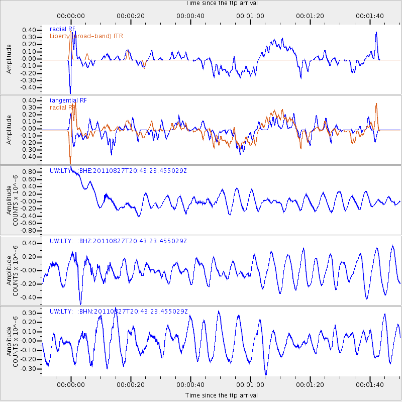
LTY Liberty (broad-band) - Earthquake Result Viewer
*The percent match for this event was below the threshold and hence no stack was calculated.
| Earthquake location: |
South Of Fiji Islands |
| Earthquake latitude/longitude: |
-24.6/179.9 |
| Earthquake time(UTC): |
2011/08/27 (239) 20:31:53 GMT |
| Earthquake Depth: |
509 km |
| Earthquake Magnitude: |
5.7 MW, 5.1 MB |
| Earthquake Catalog/Contributor: |
WHDF/NEIC |
|
| Network: |
UW Pacific Northwest Regional Seismic Network |
| Station: |
LTY Liberty (broad-band) |
| Lat/Lon: |
47.26 N/120.66 W |
| Elevation: |
970 m |
|
| Distance: |
89.3 deg |
| Az: |
35.904 deg |
| Baz: |
231.602 deg |
| Ray Param: |
$rayparam |
*The percent match for this event was below the threshold and hence was not used in the summary stack. |
|
| Radial Match: |
35.01053 % |
| Radial Bump: |
400 |
| Transverse Match: |
42.401005 % |
| Transverse Bump: |
400 |
| SOD ConfigId: |
414626 |
| Insert Time: |
2012-01-18 05:43:35.969 +0000 |
| GWidth: |
2.5 |
| Max Bumps: |
400 |
| Tol: |
0.001 |
|
Signal To Noise
| Channel | StoN | STA | LTA |
| UW:LTY: :BHZ:20110827T20:43:23.455029Z | 1.4225934 | 2.3258492E-7 | 1.6349361E-7 |
| UW:LTY: :BHN:20110827T20:43:23.455029Z | 0.7832598 | 1.1274241E-7 | 1.4393999E-7 |
| UW:LTY: :BHE:20110827T20:43:23.455029Z | 0.60215974 | 2.0960879E-7 | 3.4809497E-7 |
| Arrivals |
| Ps | |
| PpPs | |
| PsPs/PpSs | |


