You are here: Home > Network List > TA - USArray Transportable Network (new EarthScope stations) Stations List
> Station Q56A Snyder Ridge, Maysville, WV, USA > Earthquake Result Viewer
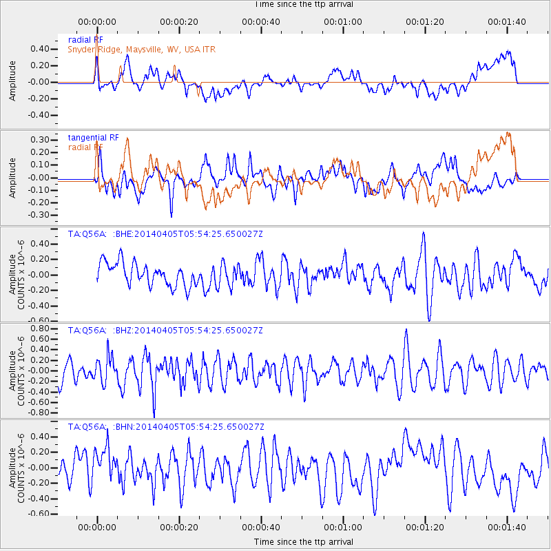
Q56A Snyder Ridge, Maysville, WV, USA - Earthquake Result Viewer
*The percent match for this event was below the threshold and hence no stack was calculated.
| Earthquake location: |
Near Coast Of Northern Chile |
| Earthquake latitude/longitude: |
-20.1/-70.5 |
| Earthquake time(UTC): |
2014/04/05 (095) 05:44:57 GMT |
| Earthquake Depth: |
39 km |
| Earthquake Magnitude: |
5.3 MW |
| Earthquake Catalog/Contributor: |
ISC/ISC |
|
| Network: |
TA USArray Transportable Network (new EarthScope stations) |
| Station: |
Q56A Snyder Ridge, Maysville, WV, USA |
| Lat/Lon: |
39.04 N/79.19 W |
| Elevation: |
430 m |
|
| Distance: |
59.4 deg |
| Az: |
352.153 deg |
| Baz: |
170.519 deg |
| Ray Param: |
$rayparam |
*The percent match for this event was below the threshold and hence was not used in the summary stack. |
|
| Radial Match: |
38.796204 % |
| Radial Bump: |
400 |
| Transverse Match: |
48.75027 % |
| Transverse Bump: |
400 |
| SOD ConfigId: |
3390531 |
| Insert Time: |
2019-04-11 04:12:21.195 +0000 |
| GWidth: |
2.5 |
| Max Bumps: |
400 |
| Tol: |
0.001 |
|
Signal To Noise
| Channel | StoN | STA | LTA |
| TA:Q56A: :BHZ:20140405T05:54:25.650027Z | 1.7418903 | 2.4467494E-7 | 1.4046518E-7 |
| TA:Q56A: :BHN:20140405T05:54:25.650027Z | 1.9197698 | 2.2968635E-7 | 1.1964266E-7 |
| TA:Q56A: :BHE:20140405T05:54:25.650027Z | 1.0130314 | 1.4696192E-7 | 1.4507144E-7 |
| Arrivals |
| Ps | |
| PpPs | |
| PsPs/PpSs | |


