You are here: Home > Network List > IU - Global Seismograph Network (GSN - IRIS/USGS) Stations List
> Station SLBS Sierra la Laguna Baja California Sur, Mexico > Earthquake Result Viewer
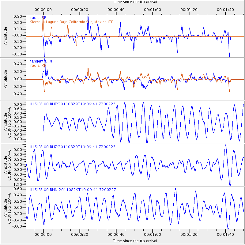
SLBS Sierra la Laguna Baja California Sur, Mexico - Earthquake Result Viewer
*The percent match for this event was below the threshold and hence no stack was calculated.
| Earthquake location: |
Vanuatu Islands |
| Earthquake latitude/longitude: |
-16.4/167.9 |
| Earthquake time(UTC): |
2011/08/29 (241) 18:57:39 GMT |
| Earthquake Depth: |
202 km |
| Earthquake Magnitude: |
5.5 MB, 5.6 MW |
| Earthquake Catalog/Contributor: |
WHDF/NEIC |
|
| Network: |
IU Global Seismograph Network (GSN - IRIS/USGS) |
| Station: |
SLBS Sierra la Laguna Baja California Sur, Mexico |
| Lat/Lon: |
23.69 N/109.94 W |
| Elevation: |
825 m |
|
| Distance: |
89.5 deg |
| Az: |
65.247 deg |
| Baz: |
251.995 deg |
| Ray Param: |
$rayparam |
*The percent match for this event was below the threshold and hence was not used in the summary stack. |
|
| Radial Match: |
47.433384 % |
| Radial Bump: |
335 |
| Transverse Match: |
67.01535 % |
| Transverse Bump: |
400 |
| SOD ConfigId: |
414626 |
| Insert Time: |
2012-01-18 05:52:44.190 +0000 |
| GWidth: |
2.5 |
| Max Bumps: |
400 |
| Tol: |
0.001 |
|
Signal To Noise
| Channel | StoN | STA | LTA |
| IU:SLBS:00:BHZ:20110829T19:09:41.720022Z | 2.0954175 | 5.81444E-7 | 2.7748362E-7 |
| IU:SLBS:00:BHN:20110829T19:09:41.720022Z | 1.1398395 | 3.4631427E-7 | 3.0382725E-7 |
| IU:SLBS:00:BHE:20110829T19:09:41.720022Z | 1.0024952 | 1.9818773E-7 | 1.9769445E-7 |
| Arrivals |
| Ps | |
| PpPs | |
| PsPs/PpSs | |


