You are here: Home > Network List > TA - USArray Transportable Network (new EarthScope stations) Stations List
> Station S22A 4UR Ranch, Creede, CO, USA > Earthquake Result Viewer
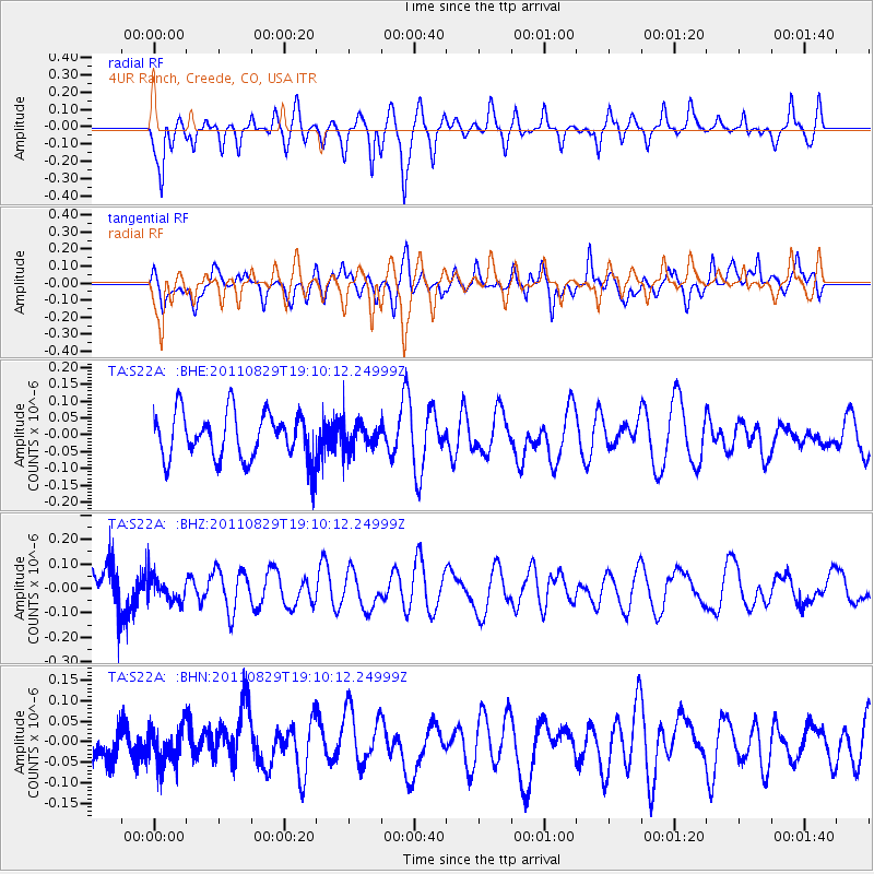
S22A 4UR Ranch, Creede, CO, USA - Earthquake Result Viewer
*The percent match for this event was below the threshold and hence no stack was calculated.
| Earthquake location: |
Vanuatu Islands |
| Earthquake latitude/longitude: |
-16.4/167.9 |
| Earthquake time(UTC): |
2011/08/29 (241) 18:57:39 GMT |
| Earthquake Depth: |
202 km |
| Earthquake Magnitude: |
5.5 MB, 5.6 MW |
| Earthquake Catalog/Contributor: |
WHDF/NEIC |
|
| Network: |
TA USArray Transportable Network (new EarthScope stations) |
| Station: |
S22A 4UR Ranch, Creede, CO, USA |
| Lat/Lon: |
37.75 N/106.83 W |
| Elevation: |
2626 m |
|
| Distance: |
96.2 deg |
| Az: |
52.613 deg |
| Baz: |
254.216 deg |
| Ray Param: |
$rayparam |
*The percent match for this event was below the threshold and hence was not used in the summary stack. |
|
| Radial Match: |
66.34784 % |
| Radial Bump: |
385 |
| Transverse Match: |
54.02886 % |
| Transverse Bump: |
400 |
| SOD ConfigId: |
414626 |
| Insert Time: |
2012-01-18 05:54:10.203 +0000 |
| GWidth: |
2.5 |
| Max Bumps: |
400 |
| Tol: |
0.001 |
|
Signal To Noise
| Channel | StoN | STA | LTA |
| TA:S22A: :BHZ:20110829T19:10:12.24999Z | 0.6437596 | 4.8669154E-8 | 7.5601434E-8 |
| TA:S22A: :BHN:20110829T19:10:12.24999Z | 0.7779125 | 4.451267E-8 | 5.7220667E-8 |
| TA:S22A: :BHE:20110829T19:10:12.24999Z | 0.5378765 | 3.676637E-8 | 6.8354666E-8 |
| Arrivals |
| Ps | |
| PpPs | |
| PsPs/PpSs | |


