You are here: Home > Network List > IW - Intermountain West Stations List
> Station PLID Pearl Lake, Idaho, USA > Earthquake Result Viewer
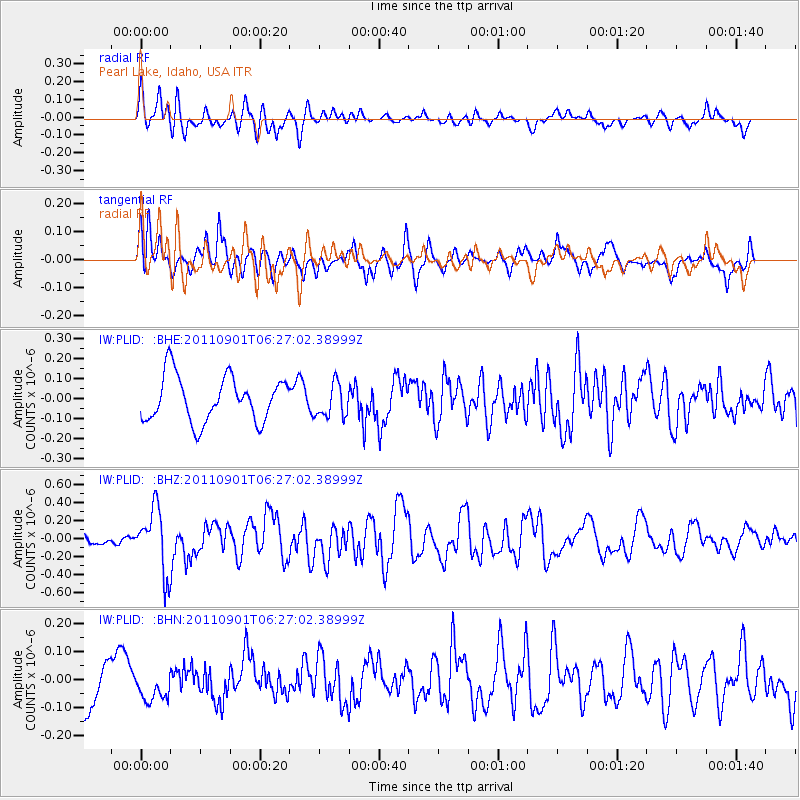
PLID Pearl Lake, Idaho, USA - Earthquake Result Viewer
*The percent match for this event was below the threshold and hence no stack was calculated.
| Earthquake location: |
Santa Cruz Islands |
| Earthquake latitude/longitude: |
-12.4/166.7 |
| Earthquake time(UTC): |
2011/09/01 (244) 06:14:38 GMT |
| Earthquake Depth: |
39 km |
| Earthquake Magnitude: |
5.7 MB, 5.6 MS, 6.1 MW, 6.0 MW |
| Earthquake Catalog/Contributor: |
WHDF/NEIC |
|
| Network: |
IW Intermountain West |
| Station: |
PLID Pearl Lake, Idaho, USA |
| Lat/Lon: |
45.09 N/116.00 W |
| Elevation: |
2164 m |
|
| Distance: |
89.9 deg |
| Az: |
43.724 deg |
| Baz: |
252.437 deg |
| Ray Param: |
$rayparam |
*The percent match for this event was below the threshold and hence was not used in the summary stack. |
|
| Radial Match: |
41.85511 % |
| Radial Bump: |
400 |
| Transverse Match: |
72.57242 % |
| Transverse Bump: |
400 |
| SOD ConfigId: |
414626 |
| Insert Time: |
2012-01-18 06:31:17.387 +0000 |
| GWidth: |
2.5 |
| Max Bumps: |
400 |
| Tol: |
0.001 |
|
Signal To Noise
| Channel | StoN | STA | LTA |
| IW:PLID: :BHZ:20110901T06:27:02.38999Z | 4.2256765 | 3.5270358E-7 | 8.346677E-8 |
| IW:PLID: :BHN:20110901T06:27:02.38999Z | 0.44005328 | 5.200783E-8 | 1.181853E-7 |
| IW:PLID: :BHE:20110901T06:27:02.38999Z | 0.73865294 | 8.302313E-8 | 1.1239803E-7 |
| Arrivals |
| Ps | |
| PpPs | |
| PsPs/PpSs | |


