You are here: Home > Network List > TA - USArray Transportable Network (new EarthScope stations) Stations List
> Station R11A Troy Canyon, Currant, NV, USA > Earthquake Result Viewer
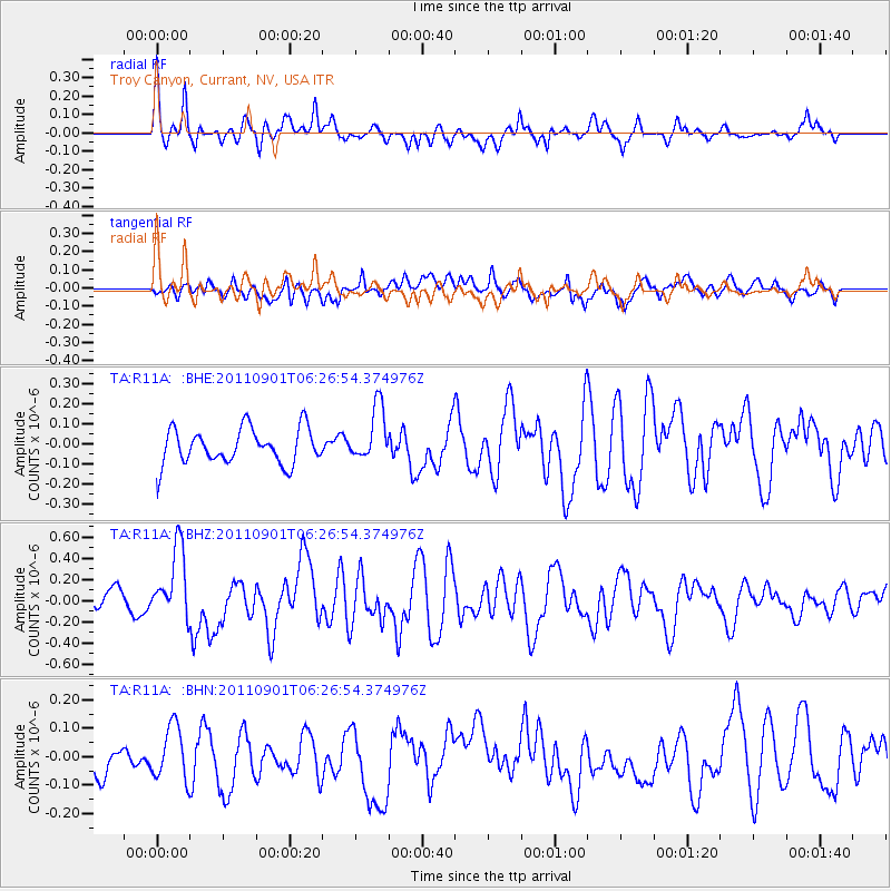
R11A Troy Canyon, Currant, NV, USA - Earthquake Result Viewer
*The percent match for this event was below the threshold and hence no stack was calculated.
| Earthquake location: |
Santa Cruz Islands |
| Earthquake latitude/longitude: |
-12.4/166.7 |
| Earthquake time(UTC): |
2011/09/01 (244) 06:14:38 GMT |
| Earthquake Depth: |
39 km |
| Earthquake Magnitude: |
5.7 MB, 5.6 MS, 6.1 MW, 6.0 MW |
| Earthquake Catalog/Contributor: |
WHDF/NEIC |
|
| Network: |
TA USArray Transportable Network (new EarthScope stations) |
| Station: |
R11A Troy Canyon, Currant, NV, USA |
| Lat/Lon: |
38.35 N/115.59 W |
| Elevation: |
1756 m |
|
| Distance: |
88.2 deg |
| Az: |
50.244 deg |
| Baz: |
252.821 deg |
| Ray Param: |
$rayparam |
*The percent match for this event was below the threshold and hence was not used in the summary stack. |
|
| Radial Match: |
56.588615 % |
| Radial Bump: |
400 |
| Transverse Match: |
60.133266 % |
| Transverse Bump: |
400 |
| SOD ConfigId: |
414626 |
| Insert Time: |
2012-01-18 06:32:54.069 +0000 |
| GWidth: |
2.5 |
| Max Bumps: |
400 |
| Tol: |
0.001 |
|
Signal To Noise
| Channel | StoN | STA | LTA |
| TA:R11A: :BHZ:20110901T06:26:54.374976Z | 3.9997706 | 3.3892437E-7 | 8.473595E-8 |
| TA:R11A: :BHN:20110901T06:26:54.374976Z | 1.194995 | 9.3806946E-8 | 7.849986E-8 |
| TA:R11A: :BHE:20110901T06:26:54.374976Z | 1.5547683 | 1.3676059E-7 | 8.796204E-8 |
| Arrivals |
| Ps | |
| PpPs | |
| PsPs/PpSs | |


