You are here: Home > Network List > UW - Pacific Northwest Regional Seismic Network Stations List
> Station OMAK Colville Reservation, Omak, WA, USA > Earthquake Result Viewer
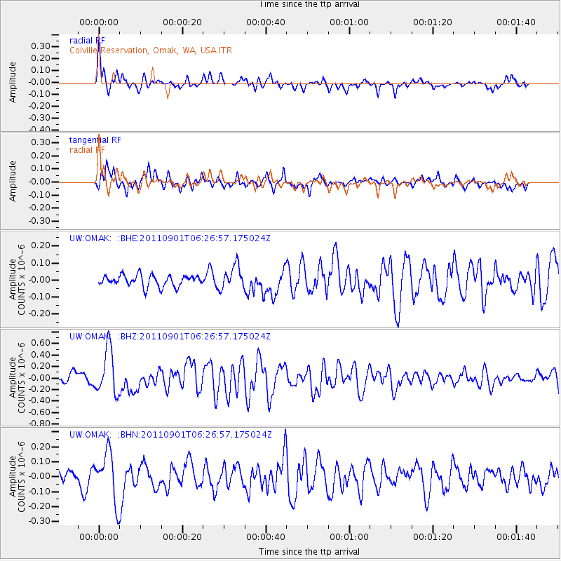
OMAK Colville Reservation, Omak, WA, USA - Earthquake Result Viewer
*The percent match for this event was below the threshold and hence no stack was calculated.
| Earthquake location: |
Santa Cruz Islands |
| Earthquake latitude/longitude: |
-12.4/166.7 |
| Earthquake time(UTC): |
2011/09/01 (244) 06:14:38 GMT |
| Earthquake Depth: |
39 km |
| Earthquake Magnitude: |
5.7 MB, 5.6 MS, 6.1 MW, 6.0 MW |
| Earthquake Catalog/Contributor: |
WHDF/NEIC |
|
| Network: |
UW Pacific Northwest Regional Seismic Network |
| Station: |
OMAK Colville Reservation, Omak, WA, USA |
| Lat/Lon: |
48.36 N/119.33 W |
| Elevation: |
696 m |
|
| Distance: |
88.8 deg |
| Az: |
39.889 deg |
| Baz: |
249.974 deg |
| Ray Param: |
$rayparam |
*The percent match for this event was below the threshold and hence was not used in the summary stack. |
|
| Radial Match: |
79.36081 % |
| Radial Bump: |
372 |
| Transverse Match: |
70.551094 % |
| Transverse Bump: |
400 |
| SOD ConfigId: |
414626 |
| Insert Time: |
2012-01-18 06:36:40.516 +0000 |
| GWidth: |
2.5 |
| Max Bumps: |
400 |
| Tol: |
0.001 |
|
Signal To Noise
| Channel | StoN | STA | LTA |
| UW:OMAK: :BHZ:20110901T06:26:57.175024Z | 4.4906955 | 4.026463E-7 | 8.966235E-8 |
| UW:OMAK: :BHN:20110901T06:26:57.175024Z | 2.7734747 | 1.6952261E-7 | 6.1122826E-8 |
| UW:OMAK: :BHE:20110901T06:26:57.175024Z | 2.1046124 | 6.919859E-8 | 3.287949E-8 |
| Arrivals |
| Ps | |
| PpPs | |
| PsPs/PpSs | |


