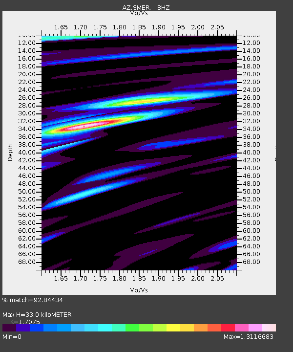
SMER AZ.SMER - Earthquake Result Viewer
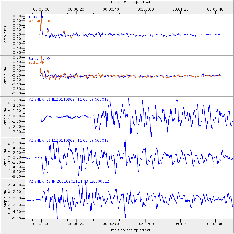
Earthquake location: Fox Islands, Aleutian Islands
Earthquake latitude/longitude: 52.2/-171.7
Earthquake time(UTC): 2011/09/02 (245) 10:55:53 GMT
Earthquake Depth: 32 km
Earthquake Magnitude: 6.5 MB, 6.9 MS, 6.8 MW, 6.8 MW
Earthquake Catalog/Contributor: WHDF/NEIC
Network: AZ ANZA Regional Network
Station: SMER AZ.SMER
Lat/Lon: 33.46 N/117.17 W
Elevation: 355 m
Distance: 43.0 deg
Az: 93.711 deg
Baz: 312.679 deg
Ray Param: 0.07275226
Estimated Moho Depth: 33.0 km
Estimated Crust Vp/Vs: 1.71
Assumed Crust Vp: 6.264 km/s
Estimated Crust Vs: 3.668 km/s
Estimated Crust Poisson's Ratio: 0.24
Radial Match: 92.84434 %
Radial Bump: 400
Transverse Match: 82.527145 %
Transverse Bump: 400
SOD ConfigId: 414626
Insert Time: 2012-01-18 06:44:54.548 +0000
GWidth: 2.5
Max Bumps: 400
Tol: 0.001

Signal To Noise

ChannelStoNSTALTA
AZ:SMER: :BHZ:20110902T11:03:19.60001Z21.6211343.6678482E-61.6964181E-7
AZ:SMER: :BHN:20110902T11:03:19.60001Z3.6755171.5835706E-64.3084296E-7
AZ:SMER: :BHE:20110902T11:03:19.60001Z4.84900431.1885996E-62.451224E-7
Arrivals
Ps4.0 SECOND
PpPs13 SECOND
PsPs/PpSs17 SECOND