You are here: Home > Network List > G - GEOSCOPE Stations List
> Station DRV Dumont d'Urville, Terre Adelie (Antartica) > Earthquake Result Viewer
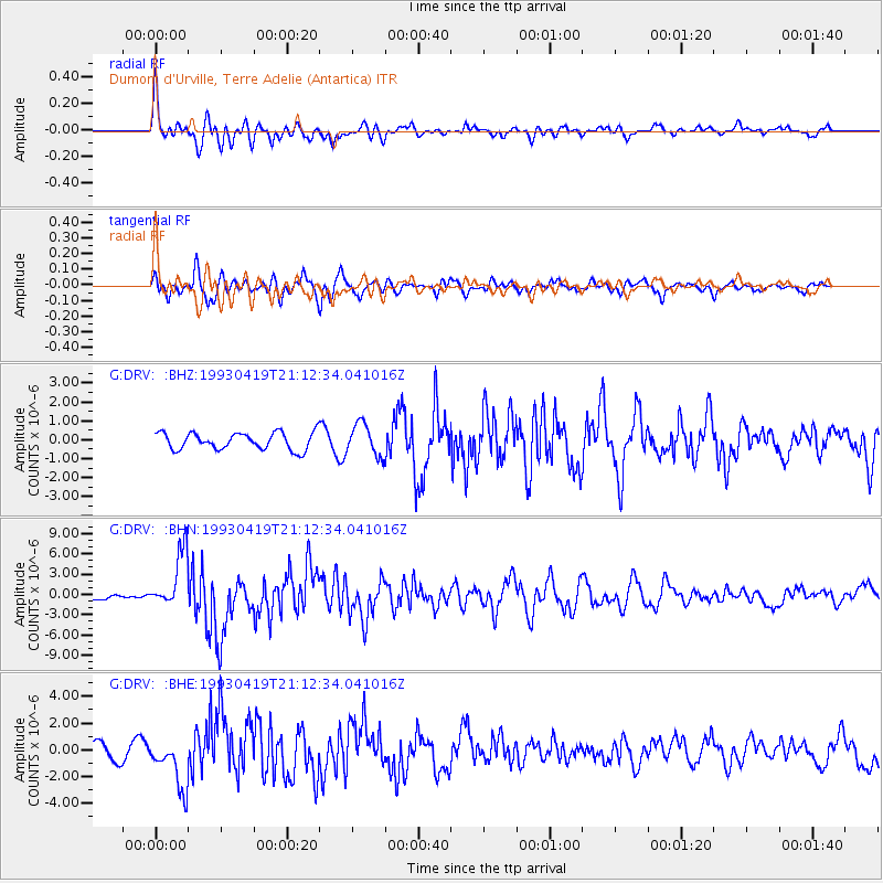
DRV Dumont d'Urville, Terre Adelie (Antartica) - Earthquake Result Viewer
*The percent match for this event was below the threshold and hence no stack was calculated.
| Earthquake location: |
North Of Halmahera, Indonesia |
| Earthquake latitude/longitude: |
4.0/128.2 |
| Earthquake time(UTC): |
1993/04/19 (109) 21:01:54 GMT |
| Earthquake Depth: |
70 km |
| Earthquake Magnitude: |
6.1 MB, 6.7 MS, 6.8 UNKNOWN |
| Earthquake Catalog/Contributor: |
WHDF/NEIC |
|
| Network: |
G GEOSCOPE |
| Station: |
DRV Dumont d'Urville, Terre Adelie (Antartica) |
| Lat/Lon: |
66.67 S/140.01 E |
| Elevation: |
40 m |
|
| Distance: |
71.0 deg |
| Az: |
175.05 deg |
| Baz: |
347.522 deg |
| Ray Param: |
$rayparam |
*The percent match for this event was below the threshold and hence was not used in the summary stack. |
|
| Radial Match: |
71.312256 % |
| Radial Bump: |
400 |
| Transverse Match: |
77.12619 % |
| Transverse Bump: |
400 |
| SOD ConfigId: |
4480 |
| Insert Time: |
2010-02-26 22:15:00.212 +0000 |
| GWidth: |
2.5 |
| Max Bumps: |
400 |
| Tol: |
0.001 |
|
Signal To Noise
| Channel | StoN | STA | LTA |
| G:DRV: :BHN:19930419T21:12:34.041016Z | 7.1441355 | 4.303927E-6 | 6.02442E-7 |
| G:DRV: :BHE:19930419T21:12:34.041016Z | 3.022883 | 1.899809E-6 | 6.284759E-7 |
| G:DRV: :BHZ:19930419T21:12:34.041016Z | 1.8632394 | 8.3336147E-7 | 4.4726485E-7 |
| Arrivals |
| Ps | |
| PpPs | |
| PsPs/PpSs | |


