SLBS Sierra la Laguna Baja California Sur, Mexico - Earthquake Result Viewer
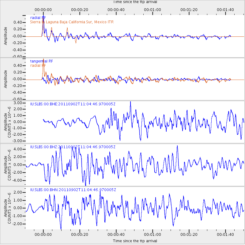
Earthquake location: Fox Islands, Aleutian Islands
Earthquake latitude/longitude: 52.2/-171.7
Earthquake time(UTC): 2011/09/02 (245) 10:55:53 GMT
Earthquake Depth: 32 km
Earthquake Magnitude: 6.5 MB, 6.9 MS, 6.8 MW, 6.8 MW
Earthquake Catalog/Contributor: WHDF/NEIC
Network: IU Global Seismograph Network (GSN - IRIS/USGS)
Station: SLBS Sierra la Laguna Baja California Sur, Mexico
Lat/Lon: 23.69 N/109.94 W
Elevation: 825 m
Distance: 54.4 deg
Az: 96.757 deg
Baz: 318.153 deg
Ray Param: 0.06540384
Estimated Moho Depth: 13.0 km
Estimated Crust Vp/Vs: 1.68
Assumed Crust Vp: 6.183 km/s
Estimated Crust Vs: 3.686 km/s
Estimated Crust Poisson's Ratio: 0.22
Radial Match: 85.101425 %
Radial Bump: 400
Transverse Match: 63.04279 %
Transverse Bump: 400
SOD ConfigId: 414626
Insert Time: 2012-01-18 06:55:14.311 +0000
GWidth: 2.5
Max Bumps: 400
Tol: 0.001

Signal To Noise

ChannelStoNSTALTA
IU:SLBS:00:BHZ:20110902T11:04:46.970005Z5.37950332.4389508E-64.5337842E-7
IU:SLBS:00:BHN:20110902T11:04:46.970005Z2.5156957.8240515E-73.1100953E-7
IU:SLBS:00:BHE:20110902T11:04:46.970005Z2.71961711.0432232E-63.835919E-7
Arrivals
Ps1.5 SECOND
PpPs5.3 SECOND
PsPs/PpSs6.8 SECOND