PQI Presque Isle, ME - Earthquake Result Viewer
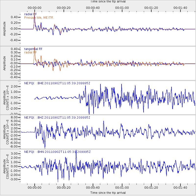
Earthquake location: Fox Islands, Aleutian Islands
Earthquake latitude/longitude: 52.2/-171.7
Earthquake time(UTC): 2011/09/02 (245) 10:55:53 GMT
Earthquake Depth: 32 km
Earthquake Magnitude: 6.5 MB, 6.9 MS, 6.8 MW, 6.8 MW
Earthquake Catalog/Contributor: WHDF/NEIC
Network: NE New England Seismic Network
Station: PQI Presque Isle, ME
Lat/Lon: 46.67 N/68.01 W
Elevation: 175 m
Distance: 61.9 deg
Az: 49.323 deg
Baz: 317.292 deg
Ray Param: 0.060522884
Estimated Moho Depth: 33.0 km
Estimated Crust Vp/Vs: 1.84
Assumed Crust Vp: 6.419 km/s
Estimated Crust Vs: 3.498 km/s
Estimated Crust Poisson's Ratio: 0.29
Radial Match: 92.38399 %
Radial Bump: 400
Transverse Match: 73.598175 %
Transverse Bump: 400
SOD ConfigId: 414626
Insert Time: 2012-01-18 07:01:27.677 +0000
GWidth: 2.5
Max Bumps: 400
Tol: 0.001

Signal To Noise

ChannelStoNSTALTA
NE:PQI: :BHZ:20110902T11:05:39.209995Z15.4265862.130711E-61.3811942E-7
NE:PQI: :BHN:20110902T11:05:39.209995Z3.54547074.79805E-71.35329E-7
NE:PQI: :BHE:20110902T11:05:39.209995Z4.4129115.640916E-71.2782755E-7
Arrivals
Ps4.5 SECOND
PpPs14 SECOND
PsPs/PpSs18 SECOND