
EMMW Machias, ME - Earthquake Result Viewer
| ||||||||||||||||||
| ||||||||||||||||||
| ||||||||||||||||||
|
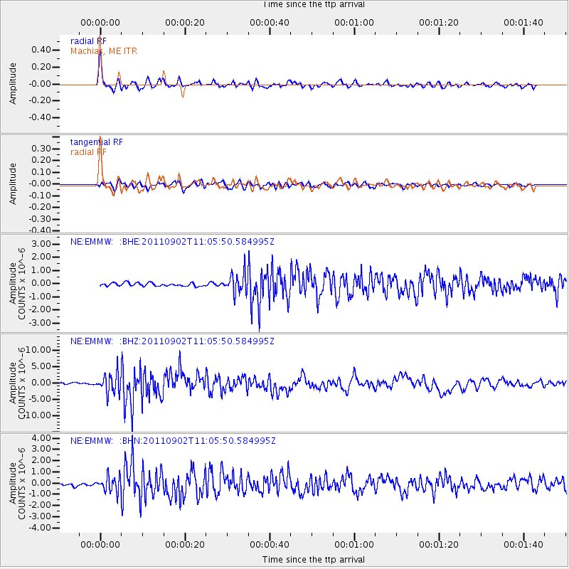
Signal To Noise
| Channel | StoN | STA | LTA |
| NE:EMMW: :BHZ:20110902T11:05:50.584995Z | 8.464126 | 2.9787898E-6 | 3.5193116E-7 |
| NE:EMMW: :BHN:20110902T11:05:50.584995Z | 4.407165 | 6.65186E-7 | 1.5093286E-7 |
| NE:EMMW: :BHE:20110902T11:05:50.584995Z | 6.0698175 | 7.3952435E-7 | 1.2183634E-7 |
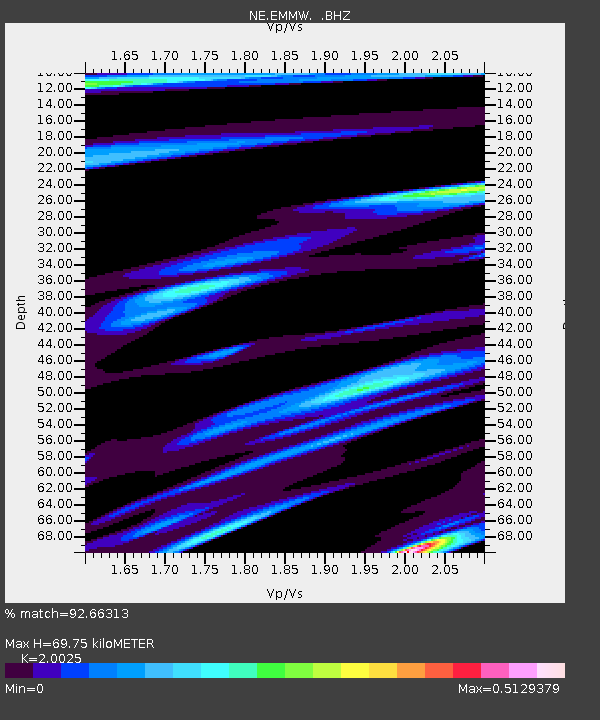
| Arrivals | |
| Ps | 11 SECOND |
| PpPs | 31 SECOND |
| PsPs/PpSs | 43 SECOND |

