Y12C Blythe, CA, USA - Earthquake Result Viewer
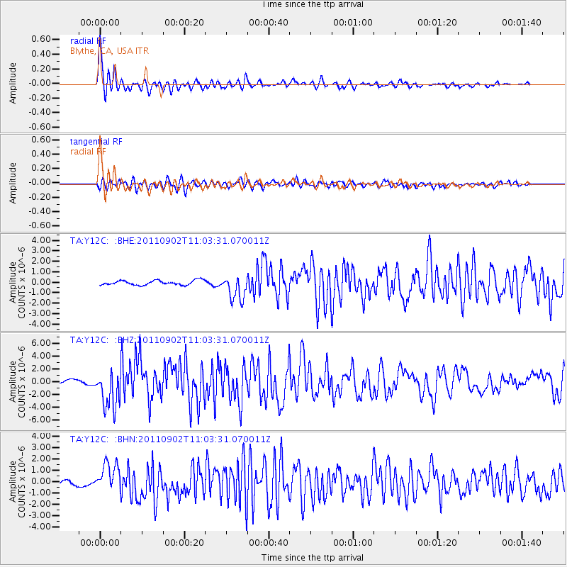
Earthquake location: Fox Islands, Aleutian Islands
Earthquake latitude/longitude: 52.2/-171.7
Earthquake time(UTC): 2011/09/02 (245) 10:55:53 GMT
Earthquake Depth: 32 km
Earthquake Magnitude: 6.5 MB, 6.9 MS, 6.8 MW, 6.8 MW
Earthquake Catalog/Contributor: WHDF/NEIC
Network: TA USArray Transportable Network (new EarthScope stations)
Station: Y12C Blythe, CA, USA
Lat/Lon: 33.75 N/114.52 W
Elevation: 196 m
Distance: 44.5 deg
Az: 91.241 deg
Baz: 312.353 deg
Ray Param: 0.07184331
Estimated Moho Depth: 18.0 km
Estimated Crust Vp/Vs: 2.10
Assumed Crust Vp: 6.155 km/s
Estimated Crust Vs: 2.934 km/s
Estimated Crust Poisson's Ratio: 0.35
Radial Match: 93.00649 %
Radial Bump: 389
Transverse Match: 80.84697 %
Transverse Bump: 400
SOD ConfigId: 414626
Insert Time: 2012-01-18 07:04:22.707 +0000
GWidth: 2.5
Max Bumps: 400
Tol: 0.001

Signal To Noise

ChannelStoNSTALTA
TA:Y12C: :BHZ:20110902T11:03:31.070011Z8.7384563.0714532E-63.5148696E-7
TA:Y12C: :BHN:20110902T11:03:31.070011Z4.98909951.2623353E-62.5301867E-7
TA:Y12C: :BHE:20110902T11:03:31.070011Z5.68016431.2279925E-62.161896E-7
Arrivals
Ps3.4 SECOND
PpPs8.6 SECOND
PsPs/PpSs12 SECOND