K04D Chiloquin, OR, USA - Earthquake Result Viewer
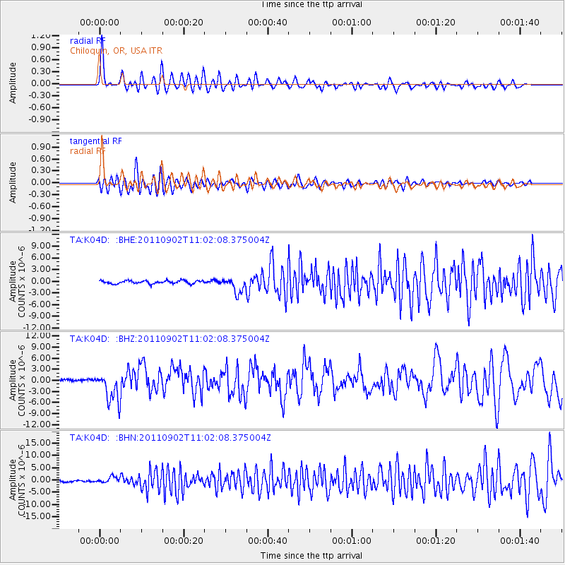
Earthquake location: Fox Islands, Aleutian Islands
Earthquake latitude/longitude: 52.2/-171.7
Earthquake time(UTC): 2011/09/02 (245) 10:55:53 GMT
Earthquake Depth: 32 km
Earthquake Magnitude: 6.5 MB, 6.9 MS, 6.8 MW, 6.8 MW
Earthquake Catalog/Contributor: WHDF/NEIC
Network: TA USArray Transportable Network (new EarthScope stations)
Station: K04D Chiloquin, OR, USA
Lat/Lon: 42.62 N/121.75 W
Elevation: 1315 m
Distance: 34.5 deg
Az: 85.807 deg
Baz: 303.674 deg
Ray Param: 0.07764857
Estimated Moho Depth: 36.0 km
Estimated Crust Vp/Vs: 1.95
Assumed Crust Vp: 6.597 km/s
Estimated Crust Vs: 3.383 km/s
Estimated Crust Poisson's Ratio: 0.32
Radial Match: 84.047424 %
Radial Bump: 400
Transverse Match: 75.241104 %
Transverse Bump: 400
SOD ConfigId: 414626
Insert Time: 2012-01-18 07:06:45.167 +0000
GWidth: 2.5
Max Bumps: 400
Tol: 0.001

Signal To Noise

ChannelStoNSTALTA
TA:K04D: :BHZ:20110902T11:02:08.375004Z23.6012544.1626895E-61.7637578E-7
TA:K04D: :BHN:20110902T11:02:08.375004Z3.70119051.2496122E-63.3762439E-7
TA:K04D: :BHE:20110902T11:02:08.375004Z5.20269252.0015289E-63.8471023E-7
Arrivals
Ps5.6 SECOND
PpPs15 SECOND
PsPs/PpSs21 SECOND