
X33A Lawton, OK, USA - Earthquake Result Viewer
| ||||||||||||||||||
| ||||||||||||||||||
| ||||||||||||||||||
|
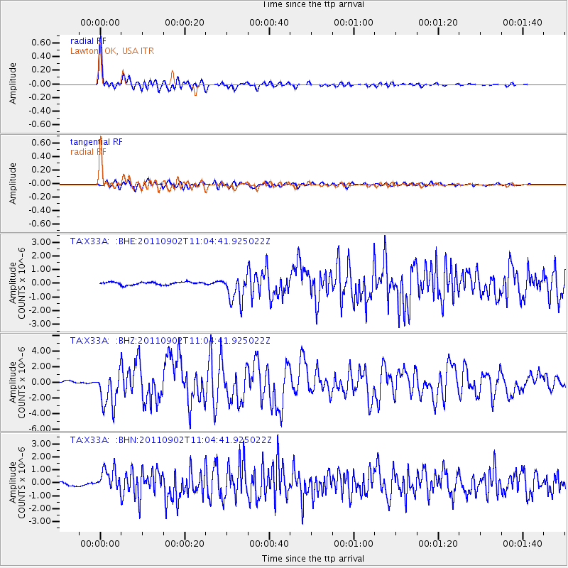
Signal To Noise
| Channel | StoN | STA | LTA |
| TA:X33A: :BHZ:20110902T11:04:41.925022Z | 12.26506 | 2.3562568E-6 | 1.9211132E-7 |
| TA:X33A: :BHN:20110902T11:04:41.925022Z | 7.489593 | 8.575105E-7 | 1.144936E-7 |
| TA:X33A: :BHE:20110902T11:04:41.925022Z | 9.847093 | 1.0087352E-6 | 1.02439905E-7 |
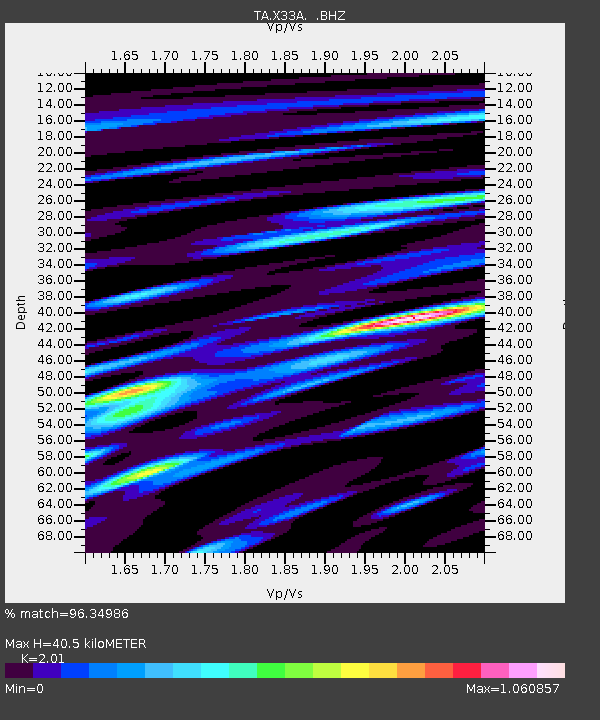
| Arrivals | |
| Ps | 6.8 SECOND |
| PpPs | 18 SECOND |
| PsPs/PpSs | 25 SECOND |

