N02D Trinity Center, CA, USA - Earthquake Result Viewer
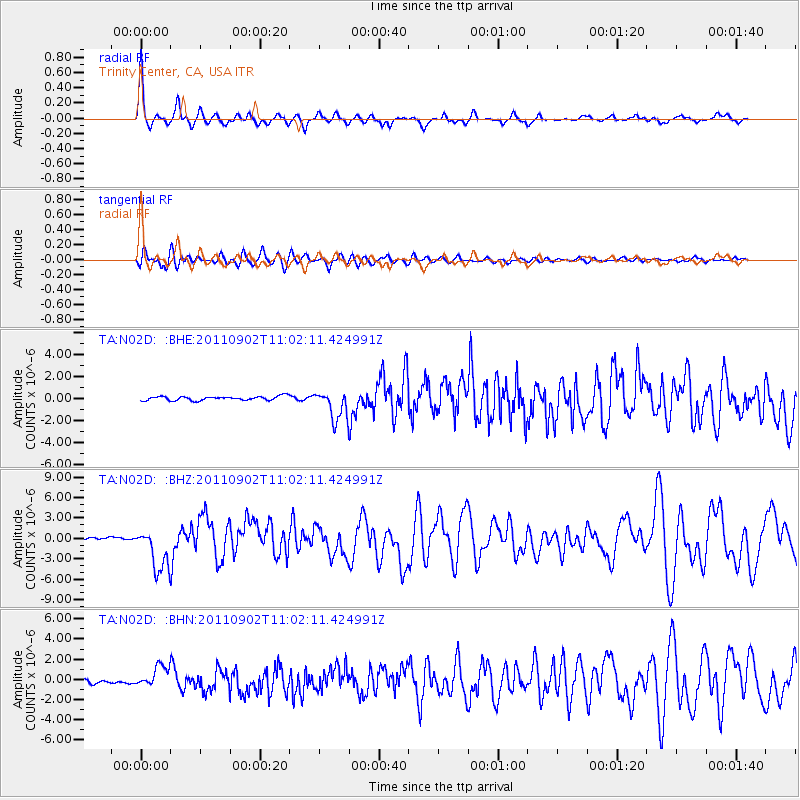
Earthquake location: Fox Islands, Aleutian Islands
Earthquake latitude/longitude: 52.2/-171.7
Earthquake time(UTC): 2011/09/02 (245) 10:55:53 GMT
Earthquake Depth: 32 km
Earthquake Magnitude: 6.5 MB, 6.9 MS, 6.8 MW, 6.8 MW
Earthquake Catalog/Contributor: WHDF/NEIC
Network: TA USArray Transportable Network (new EarthScope stations)
Station: N02D Trinity Center, CA, USA
Lat/Lon: 40.97 N/122.71 W
Elevation: 937 m
Distance: 34.9 deg
Az: 88.902 deg
Baz: 305.587 deg
Ray Param: 0.07746677
Estimated Moho Depth: 14.25 km
Estimated Crust Vp/Vs: 2.07
Assumed Crust Vp: 6.566 km/s
Estimated Crust Vs: 3.18 km/s
Estimated Crust Poisson's Ratio: 0.35
Radial Match: 87.53091 %
Radial Bump: 321
Transverse Match: 79.277145 %
Transverse Bump: 400
SOD ConfigId: 414626
Insert Time: 2012-01-18 07:08:11.693 +0000
GWidth: 2.5
Max Bumps: 400
Tol: 0.001

Signal To Noise

ChannelStoNSTALTA
TA:N02D: :BHZ:20110902T11:02:11.424991Z18.1346933.157434E-61.7411014E-7
TA:N02D: :BHN:20110902T11:02:11.424991Z3.24380561.0511108E-63.2403628E-7
TA:N02D: :BHE:20110902T11:02:11.424991Z7.2313851.3588718E-61.8791307E-7
Arrivals
Ps2.5 SECOND
PpPs6.2 SECOND
PsPs/PpSs8.7 SECOND