533A Kerrville, TX, USA - Earthquake Result Viewer
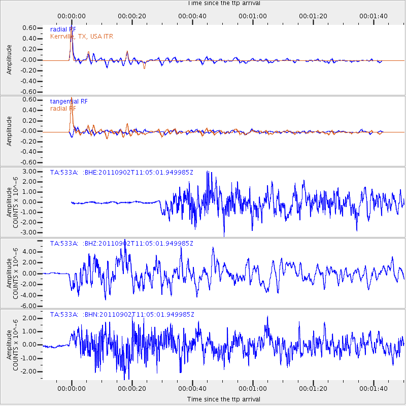
Earthquake location: Fox Islands, Aleutian Islands
Earthquake latitude/longitude: 52.2/-171.7
Earthquake time(UTC): 2011/09/02 (245) 10:55:53 GMT
Earthquake Depth: 32 km
Earthquake Magnitude: 6.5 MB, 6.9 MS, 6.8 MW, 6.8 MW
Earthquake Catalog/Contributor: WHDF/NEIC
Network: TA USArray Transportable Network (new EarthScope stations)
Station: 533A Kerrville, TX, USA
Lat/Lon: 30.07 N/99.04 W
Elevation: 556 m
Distance: 56.5 deg
Az: 82.86 deg
Baz: 315.173 deg
Ray Param: 0.06403901
Estimated Moho Depth: 46.5 km
Estimated Crust Vp/Vs: 1.73
Assumed Crust Vp: 6.498 km/s
Estimated Crust Vs: 3.767 km/s
Estimated Crust Poisson's Ratio: 0.25
Radial Match: 96.124954 %
Radial Bump: 362
Transverse Match: 86.30522 %
Transverse Bump: 400
SOD ConfigId: 414626
Insert Time: 2012-01-18 07:08:39.322 +0000
GWidth: 2.5
Max Bumps: 400
Tol: 0.001

Signal To Noise

ChannelStoNSTALTA
TA:533A: :BHZ:20110902T11:05:01.949985Z17.8625351.8626353E-61.0427609E-7
TA:533A: :BHN:20110902T11:05:01.949985Z6.8969786.9443075E-71.0068624E-7
TA:533A: :BHE:20110902T11:05:01.949985Z14.8598577.988914E-75.3761713E-8
Arrivals
Ps5.5 SECOND
PpPs18 SECOND
PsPs/PpSs24 SECOND